
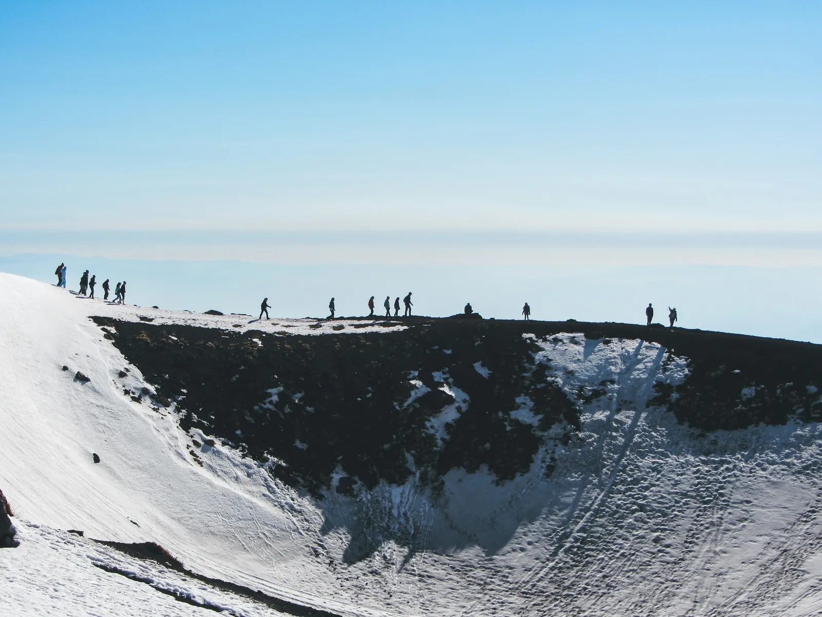
Mount Etna tour or go on your own?
I live at the other end of Sicily, and the question friends ask before an Etna day is always the same: do we need to book a tour? My answer is that it depends on how high you want to go and on whether you have a car, not on safety at the bottom. The lower slopes, the car park at the Rifugio Sapienza and the Silvestri craters (for a small fee) are open to anyone whenever the road is open. The summit area is a different matter, and that is where a guide stops being optional.
A rough way to decide:
- You have a car and want to see lava fields and old craters: go on your own and walk the Silvestri craters, then decide on the cable car when you see the weather.
- You have no car and are staying in Catania: the AST bus works, but it gives you about six hours on the mountain and no say in the timing.
- You are staying in Taormina without a car: a tour with a pickup is the simple answer, because there is no public bus from Taormina to either side of the volcano.
- You want to stand near the summit craters: you need a licensed guide whichever way you arrive, and that is what the official Tour 3000 and the private guided tours sell.
My Mount Etna guide covers the volcano's height, its eruptions and how to follow live activity, my guide to the volcanoes of Sicily adds Stromboli and Vulcano, and my wider guide to eastern Sicily covers Taormina, Catania and Syracuse. This page is the practical part: how to get up, with whom, and how high you are allowed to go. If you would rather book a guided tour of the whole island, my guide to Sicily tours and vacation packages weighs up the options.
Etna excursion from Taormina
Taormina is where many visitors to this coast stay, and it is the hardest base for Etna without a car. Both the south side (Rifugio Sapienza, above Nicolosi) and the north side (Piano Provenzana, above Linguaglossa) are roughly the same distance away by road.
| From Taormina to | Distance by road | Driving time |
|---|---|---|
| Rifugio Sapienza (Etna south, cable car) | About 55 km (34 miles) | About 80 minutes |
| Piano Provenzana (Etna north) | About 47 km (29 miles) | About 75 minutes |
Renting a car for the day gives you the most freedom: you can be on the mountain early and leave when the cloud comes in. Mountain roads above Zafferana and Nicolosi are well surfaced but steep and winding, and in winter they can need snow chains or close. Fill up with gas in the villages before you climb.
Without a car, the tours that run from Taormina pick you up at your hotel or at a meeting point in town. I am not naming companies or prices here, because I have no official source for them and they change with the season.
When you compare them, ask three things: does the price include the cable car (about €54 on its own), how high does the tour go and with whom, and which side of the volcano you are going to. A tour that stays at the car park and the Silvestri craters is a very different day from one that takes the cable car and the 4x4 bus to about 3,000 m.
Getting to Mount Etna from Catania
Catania is the easier base. AST runs one bus a day to the Rifugio Sapienza on the south side, every day except 25 December, 1 January, 1 May, 15 August and Easter Sunday:
- Leaves Catania at 8:15am from Piazza Giovanni XXIII, the square outside Catania Centrale station.
- Takes about two hours.
- Leaves the Rifugio Sapienza for Catania at 4:30pm.
- Costs about €6.60 (about $7) return, and you can buy the ticket on the bus. Buying ahead does not reserve you a seat.
That leaves you about six hours on the mountain, enough for the Silvestri craters, the cable car and the Tour 3000 if the weather holds. By car it is about 41 km (25 miles), roughly 70 minutes, from the centre of Catania to the Rifugio Sapienza. If you are on a cruise ship in Catania, my Messina and Catania cruise port guide explains why the bus times rarely fit a port day.
The Etna cable car and the Tour 3000
The Funivia dell'Etna is the only cable car on the volcano. It climbs from the Rifugio Sapienza at about 1,920 m (6,300 ft) to 2,500 m (8,200 ft). Its own prices, which I have taken from the operator's site:
| Ticket | What you get | About |
|---|---|---|
| 2500 | Cable car up and down, to 2,500 m (8,200 ft) | €54 ($59) |
| Tour 3000 | Cable car, then 4x4 bus or snowcat and an alpine or volcano guide to about 3,000 m (9,840 ft); about 2.5 hours | €82 ($90) |
The cable car runs daily from 8:30am to 4:45pm, with the last ride down at 5:15pm, weather permitting. Tour 3000 tickets are sold from 8:30am to 3:15pm. About 3,000 m is, in the operator's words, the maximum altitude allowed by the authorities, so even the official tour does not take you to the summit craters themselves.
Wear hiking shoes and bring a windproof jacket. If you have come in sneakers, windbreakers, boots and poles can be rented at the 2,500 m station. It is a different climate up there, colder and windier than on the coast, so bring a warm layer even in summer.
The cheapest option is the Silvestri craters, two cones left by the eruption of 9 July 1892, a few minutes from the Rifugio Sapienza car park. The upper crater is at 1,986 m and the lower at 1,886 m, a visit takes about 30 minutes, and the path is accessible to visitors with disabilities. There is an access fee of about €5 ($5.50), the entrance is on the road to the car park, and they are open daily from 8:30am to 5pm.
Do you need a guide to hike Mount Etna?
To get near the summit craters, yes. Access to the top of Etna is set by orders from the mayors of the towns around it, under the regional Civil Protection, and they are rewritten whenever the volcano's activity changes. The ones in force when I wrote this page, Nicolosi's order no. 12 of 29 August 2025 and Belpasso's order no. 135 of 10 August 2026, say:
- The summit zone takes in the summit craters, the upper Valle del Bove down to 1,700 m (5,600 ft), roughly everything above 2,500 m (8,200 ft) on the south, west and north sides, and a safety strip around any active lava flow or vent, whatever its altitude.
- Inside it, around the active summit craters, is the Zona a Pericolosità Permanente (ZPP), which replaced the old yellow zone in August 2025. It can only be entered with an authorised alpine or volcano guide (Guide Alpine e Vulcanologiche), with proper equipment and a helmet; Belpasso's order allows no more than 10 people per guide.
- Rules for walking on your own in the rest of the summit zone differ from town to town and change with the alert level, so check the current order or go with a guide.
- In the pre-alarm phase the ZPP is closed to everyone, guided or not, and in the alarm phase the whole summit zone is closed.
- Keep well back from any lava flow: the Nicolosi and Belpasso orders forbid going closer than 50 m (about 165 ft).
On the day, the guides decide how far it is safe to go. Before you book anything, look up the current order on the Comune di Nicolosi site, linked below, or ask the Etna park; my guide to Etna eruptions and Catania flights explains where the alert levels are published, and my Mount Etna guide shows how to follow the volcano's activity through INGV, the national volcano institute.
Mount Etna hikes you can do on your own
The Parco dell'Etna has marked nature trails on the lower slopes, below the summit zone, that you can walk without a guide. Three that suit a first visit, with the park's own figures:
| Trail | Start | Length and climb | Time | Level |
|---|---|---|---|---|
| Monti Sartorius | Forestry barrier near Rifugio Citelli, north-east side (Sant’Alfio), 1,660 m | About 4 km (2.5 miles) loop, 100 m (330 ft) | About 2 hours | Easy |
| Monte Nero degli Zappini | The plain west of Monte Vetore, south side, 1,740 m | About 4 km (2.5 miles), 200 m (660 ft) | About 2.5 hours | Easy |
| Schiena dell’Asino | Junction of the Zafferana to Rifugio Sapienza road (SP92) with the SP401 | About 5 km (3.1 miles) there and back, 250 m (820 ft) | About 4 hours | Medium |
Monti Sartorius crosses the lava of 1865 through woods of Etna birch. Monte Nero degli Zappini, opened in 1991 as Sicily's first nature trail, passes lava flows from 1985 to 2001 and lava tubes, and reaches the Nuova Gussonea botanical garden. The Schiena dell'Asino climbs to about 2,050 m (6,730 ft) on the rim above the Valle del Bove, the great valley on the eastern flank; the valley floor below is inside the guided-only zone, so enjoy it from the edge.
None of these needs special kit beyond proper shoes, water and a layer for the wind, but mountain weather changes fast. Tell someone where you are going, and keep to the marked path: the lava is sharp and a fall on it hurts.
Etna wine tours, sunset tours and the Alcantara Gorges
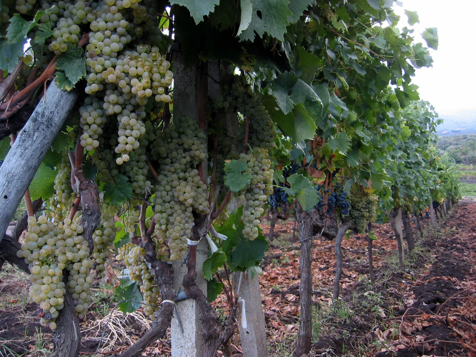
Many Etna tours pair the volcano with something else. The same three questions apply to all of them: what is included, how high you go and with whom, and which side of the volcano you visit.
- Wine tours. They visit wineries on the lower slopes. Etna was Sicily's first DOC wine area, in 1968, and its vineyards, mostly on the north, east and south sides, climb to around 1,000 m (3,300 ft). My guide to Sicilian wine explains Etna Rosso and Etna Bianco and how winery visits work. On the western slopes, the town of Bronte grows Sicily's best-known pistachios; see my guide to Bronte pistachio.
- Sunset tours. They go up in the afternoon and come down after dark. They follow the same access rules as any other tour, so a sunset tour does not take you nearer the summit craters than a daytime one.
- Jeep and 4x4 tours. They use tracks on the slopes, but the summit rules above still apply to them.
- Lava tubes. These are the tunnels a lava flow leaves behind when its surface cools and the molten rock inside drains away. The Monte Nero degli Zappini trail above passes several; go inside a lava cave only with a guide.
- The Alcantara Gorges. The river has cut a gorge of basalt columns through old lava about 19 km (12 miles) from Taormina, so tours from Taormina often combine it with Etna. My guide to hiking in Sicily explains how to visit it.
Is Mount Etna worth it, and when to go
It is, even if you never go above the cable car. Standing on a cone that formed in 1892, looking down towards the sea, gives you the scale of the volcano better than any photo. Go early, so you have time in hand if the weather turns.
Etna is also one of the few places in Sicily where the season reverses. In winter the upper slopes are under snow and the cable car and roads can close in bad weather, while in summer the mountain is the cool escape from the coast. For the rest of your trip, my guide to the best time to visit Sicily and the Nicolosi, Taormina and Catania town pages will help you plan.
Staying nearby? See my guides to things to do in Catania and things to do in Taormina, and for more walks, my guide to hiking in Sicily.
Frequently asked questions
Do you need a tour to visit Mount Etna?
No, not for the lower slopes. You can drive or take the AST bus from Catania to the Rifugio Sapienza, walk the Silvestri craters and ride the cable car to 2,500 m on your own. You need an authorised alpine or volcano guide to go near the summit craters, which is what the official Tour 3000 and the private guided tours provide.
How do you get to Mount Etna from Taormina?
By car or on a tour. The Rifugio Sapienza on the south side is about 55 km (34 miles), roughly 80 minutes, from Taormina, and Piano Provenzana on the north side about 47 km (29 miles), roughly 75 minutes. There is no public bus from Taormina to either side, so without a car a tour with a hotel pickup is the practical choice.
Is there a bus from Catania to Mount Etna?
Yes. AST runs one bus a day from Piazza Giovanni XXIII, outside Catania Centrale station, at 8:15am to the Rifugio Sapienza, and back at 4:30pm. It takes about two hours each way and the return ticket is about €6.60, sold on the bus. It does not run on 25 December, 1 January, 1 May, 15 August or Easter Sunday.
How much is the cable car on Mount Etna?
About €54 return to 2,500 m, according to the Funivia dell’Etna. The Tour 3000, with the cable car, a 4x4 bus and a guide to about 3,000 m, is about €82. The cable car runs daily from 8:30am, weather permitting, with the last ride down at 5:15pm.
Can you hike to the top of Mount Etna?
Only with an authorised guide, and only when the volcano allows it. The local orders limit the summit zone, roughly above 2,500 m, close the area around the summit craters when the alert level rises, and close the whole summit zone at the highest alert level. Even the official Tour 3000 stops at about 3,000 m, which the operator says is the maximum altitude the authorities allow.
How long does a Mount Etna hike take?
The Silvestri craters take about 30 minutes. The park’s easy nature trails, Monti Sartorius and Monte Nero degli Zappini, take about two to two and a half hours for about 4 km, and the Schiena dell’Asino, to the rim of the Valle del Bove, about four hours there and back. The Tour 3000 from the cable car lasts about two and a half hours.
What should I wear to Mount Etna?
Hiking shoes and a windproof jacket, with a warm layer even in summer, plus a hat, water and sunscreen. Above the cable car it is colder and windier than on the coast. Jackets, boots and poles can be rented at the 2,500 m cable car station.
Is it safe to visit Mount Etna?
Yes, in the areas that are open, and the rules are there to keep it that way. Access to the summit zone is set by orders from the mayors of the towns around Etna and changes with the volcano’s activity: the area around the summit craters can only be entered with an authorised guide, and it closes to everyone when the alert level rises. Before you go, check the current order and the updates from INGV, the national volcano institute, and on the mountain follow what the guides and the cable car staff tell you.
Which is better, the north or the south side of Etna?
The south side, from the Rifugio Sapienza, has the cable car, the Silvestri craters, the AST bus from Catania and most of the tours. The north side, from Piano Provenzana above Linguaglossa, is quieter and greener, with the Monti Sartorius trail nearby, but you need a car or a tour to reach it.
Sources and small print
- Funivia dell'Etna, cable car times and prices, the Tour 3000 and the Silvestri craters
- Comune di Nicolosi, mayor's order no. 12 of 29 August 2025 on access to the summit zone and the Zona a Pericolosità Permanente, and the Comune di Belpasso order no. 135 of 10 August 2026 (copy published by CAI Catania)
- Parco dell'Etna, the park authority, nature trail sheets for Monti Sartorius, Monte Nero degli Zappini and the Schiena dell'Asino
- AST, the Catania to Etna bus
- INGV Osservatorio Etneo, the national volcano institute, for the volcano's current state
Driving times are measured on the road network without traffic and rounded. The rules for the summit change with the volcano, so check the current order before you go.
Credits
Photo: Casey Lovegrove, Unsplash Licence, via Unsplash.
Photo: Neil Weightman, CC BY 2.0, via Wikimedia Commons.
 The weekly YouTube series