
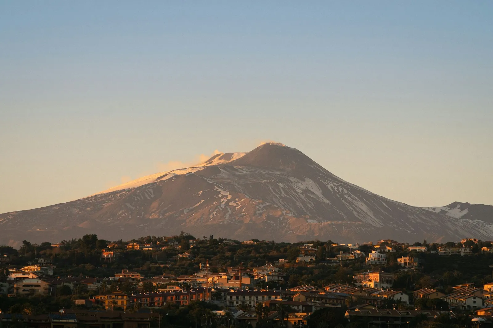
Where is Mount Etna?
Mount Etna stands on the east coast of Sicily, the island at the toe of Italy's boot, inside the province (officially the metropolitan city) of Catania. The Smithsonian's Global Volcanism Program places its summit at 37.75°N, 15.00°E. Catania, Sicily's second city, spreads over its lower southern slopes; Taormina looks across at it from the hills to the northeast.
The volcano is far bigger than its summit suggests. Britannica gives it an area of some 600 square miles (1,600 km²) and a base about 93 miles (150 km) around, and a ring of towns sits on its flanks: Nicolosi and Zafferana Etnea on the south and east, Linguaglossa and Randazzo on the north, Bronte and Adrano on the west. On the eastern side the Valle del Bove, a great collapsed hollow about 3 by 6 miles (5 by 10 km), opens towards the sea.
If you want to place Etna on a map of the whole island, my map of Sicily shows it with the provinces, cities and airports.
How tall is Mount Etna?
About 3,350 m, or 11,000 ft, but the honest answer is that it depends on the year. Like any active volcano, Etna grows when an eruption piles material onto a crater rim and shrinks when a rim collapses. Britannica notes that in 1865 the summit was about 170 ft (52 m) higher than in the early 21st century, and today it gives a height of about 3,320 m (10,900 ft). INGV's own measurements show how fast it moves:
| When | Highest point | Which crater |
|---|---|---|
| 10 August 2021 | 3,347 m (10,981 ft) | South-East Crater, overtaking the North-East Crater, highest since the late 1970s |
| 1 December 2023 | 3,354 m (11,004 ft) | South-East Crater, after another paroxysm |
| July 2024 | About 3,369 m (11,053 ft) | The rim of the Voragine, after paroxysms on 4 and 7 July; the greatest height ever measured on Etna |
The summit is not a single peak but a cluster of four craters: the Voragine and the Bocca Nuova in the middle, the North-East Crater and the South-East Crater. Which one is highest, and which ones are active, changes from one eruption to the next.
Mount Etna facts
| Mount Etna | |
|---|---|
| Where | East coast of Sicily, Italy, in the province of Catania |
| Height | About 3,350 m (11,000 ft); it changes with eruptions |
| Type | Stratovolcano, built over an older shield volcano |
| Size | About 600 sq mi (1,600 km²), base about 93 miles (150 km) around |
| Eruptive history | Can be traced back about 500,000 years; at least 2,700 years of it documented |
| Records of eruptions | From about 1500 BCE |
| UNESCO World Heritage Site | Since 21 June 2013, covering 19,237 hectares of the upper mountain |
| Etna Park | Set up on 17 March 1987, the first of Sicily's regional parks, about 59,000 hectares |
| Names | Etna, from the Greek Aitne ("I burn"); Sicilians also call it Mongibello |
UNESCO calls Etna the highest Mediterranean island mountain and the most active stratovolcano in the world, and Britannica calls it the highest active volcano in Europe. Its slopes change as you climb: Britannica describes fertile lower slopes with vineyards, olive groves, citrus and orchards up to about 3,000 ft (915 m), forests of chestnut, beech, oak, pine and birch above that, and bare ash, sand and lava beyond about 6,500 ft (1,980 m). That volcanic soil is behind the Etna wines in my guide to Sicilian wine.
The Greeks told stories about it: Britannica recounts that they saw it as the forge of Hephaestus and the Cyclopes, or the prison of the giant Typhon, whose turning made the earth shake.
Mount Etna eruption history
Etna erupts in two ways, according to the Global Volcanism Program: persistent explosive activity from the summit craters, sometimes with small lava flows, and less frequent eruptions from fissures on its flanks, which usually pour out more lava and are the ones that have reached towns. These are some of the eruptions that the sources I used single out:
| Year | What happened |
|---|---|
| 475 BCE | A famous eruption mentioned by the Greek writers Pindar and Aeschylus |
| 396 BCE | An eruption that kept the Carthaginian army from reaching Catania |
| 1381 | A lava flow reached the Ionian Sea, about 10 miles (16 km) away |
| 1669 (11 March to 15 July) | The most violent eruption in recorded history. A fissure opened above Nicolosi, built the Monti Rossi cones, destroyed about a dozen villages and buried the western part of Catania. Workers dug a trench to turn the lava away from the city, the first known attempt to divert a lava flow |
| 1852 to 1853 | Flattened large areas of forest and nearly destroyed Zafferana |
| 1928 | Cut the railway around the base of the mountain and buried the village of Mascali |
| 1971 | Threatened several villages and destroyed orchards and vineyards |
| 1983 | A four-month eruption; the authorities used dynamite to try to divert the lava |
| 15 December 1991 to 30 March 1993 | 473 days of lava flows into the Valle del Bove, probably the largest eruption in 300 years. The lava threatened Zafferana Etnea; earth barriers were built and explosives were used to break the flow's bank and divert it |
| July 2001 | A major flank eruption that lasted several weeks |
| 2021 | A series of paroxysms at the South-East Crater, which became the highest point on 10 August |
| 4 and 7 July 2024 | Lava fountains at the Voragine raised its rim to about 3,369 m, a new record height |
| 2 June 2025 | An eruption sent a volcanic cloud to around 21,000 ft (6,400 m), set off a red alert for aircraft and disrupted tourist visits |
The 1669 lava is still part of Catania's story: much of the city was rebuilt in black volcanic stone after it and the earthquake of 1693, which my guide to eastern Sicily covers. For the longer history of the island, see Sicily's past and power.
Is Mount Etna erupting now? How to follow live activity
Etna is watched around the clock by INGV's Osservatorio Etneo in Catania. Its site is in Italian, but the pages are easy to find from the home page, under "Monitoraggio e sorveglianza":
- Comunicati attività vulcanica, the volcanic activity statements, issued when something changes.
- Bollettini multidisciplinari, the weekly bulletins, which sum up what the volcano has done.
- Video sorveglianza, the surveillance webcams, and the volcanic tremor graph.
- VONA, the notices for aviation, and an ash dispersion forecast showing where any ash would drift.
INGV's blog, INGVvulcani, explains the bigger events in plain Italian, often with photos and video. A word you will meet there is "parossismo", a paroxysm: a short, violent episode, often with lava fountains and a tall ash column, which can come and go within hours.
Two other things are worth knowing. If you are flying, the eruption and your flight are different questions: my guide to Etna eruptions and Catania airport explains what to check and your rights. And if you plan to go up the mountain, access to the summit area is set by local orders that change with the alert level, which my Mount Etna tours and hikes guide covers.
Mount Etna weather
Etna makes its own weather. The upper slopes are under snow in winter while Catania, at sea level, stays mild, and even on a hot summer day it is colder and windier at the cable car station at 2,500 m (8,200 ft) than on the coast, so bring a warm layer whatever the month. Cloud often gathers around the summit by midday, which is one reason to go early.
The snow is real enough for skiing: there are ski lifts on the north side at Piano Provenzana, above Linguaglossa, and on the south side above Nicolosi, where the Etna cable car also runs. Whether they open depends on each winter's snow and on the volcano.
For a forecast, use the Italian Air Force weather service, meteoam.it, and search for Nicolosi or Linguaglossa for the lower slopes; remember that the summit, more than half a mile higher, will be far colder and windier. When the volcano is active, the wind also decides where any ash falls, which is what INGV's ash dispersion forecast shows. For the season as a whole, my guide to the best time to visit Sicily covers the island month by month.
Visiting Mount Etna
You can see Etna from much of eastern Sicily without going anywhere near it: from Catania's streets, from the Greek theatre in Taormina, or from the Circumetnea railway that runs around its base. To go up, most visitors drive or take the bus to the Rifugio Sapienza on the south side, walk the old Silvestri craters and ride the cable car; going near the summit craters needs an authorised guide. I cover all of that, with the bus, the cable car prices, the trails and the guide rules, in Mount Etna tours and hikes from Taormina and Catania.
Etna is one of two very active volcanoes in Sicily; the other is Stromboli, off the north coast. My guide to the volcanoes of Sicily covers Stromboli, Vulcano, Pantelleria and the rest.
Frequently asked questions
Where is Mount Etna in Sicily?
On the east coast of Sicily, in the province of Catania. Its summit is about 17 miles (28 km) in a straight line from the center of Catania and about the same from Taormina, and Catania airport sits below its southern slopes.
Is Mount Etna in Sicily or Italy?
Both. Mount Etna is on the island of Sicily, which is an autonomous region of Italy, so the volcano is in Italy. It is the highest active volcano in Europe.
How tall is Mount Etna?
About 3,350 m (11,000 ft), but the height changes with eruptions. INGV measured about 3,369 m at the rim of the Voragine crater in July 2024, the greatest height ever recorded on Etna, while Britannica gives about 3,320 m.
Is Mount Etna erupting right now?
Etna is often active, but only a live source can say what it is doing today. Check the volcanic activity statements, weekly bulletins and webcams of INGV’s Etna Observatory at ct.ingv.it. If you are flying, check your airline and Catania airport as well.
When was the last eruption of Mount Etna?
Etna erupts so often that any date goes out of date quickly. Recent events include the lava fountains at the Voragine on 4 and 7 July 2024 and an eruption on 2 June 2025 that sent a volcanic cloud to around 21,000 ft. INGV’s statements and weekly bulletins give the latest.
What was the worst eruption of Mount Etna?
The eruption of 11 March to 15 July 1669 is the most violent in recorded history, according to Britannica. Lava from a fissure above Nicolosi destroyed about a dozen villages and buried the western part of Catania.
Is Mount Etna the biggest volcano in Europe?
It is the highest active volcano in Europe, according to Britannica, and UNESCO calls it the highest mountain on any Mediterranean island. The Smithsonian’s Global Volcanism Program describes its edifice as the highest and most voluminous in Italy.
Is Mount Etna still active?
Yes. Etna is one of the most active volcanoes in the world: UNESCO calls it the most active stratovolcano anywhere, and its eruptions have been documented for at least 2,700 years. INGV’s Etna Observatory in Catania monitors it continuously, and its statements, bulletins and webcams at ct.ingv.it are the place to check what it is doing on any given day.
Is it safe to visit Sicily when Etna is erupting?
Usually, yes. Most of Sicily is far from the volcano, and on the coast below it the main nuisance is ash, which can fall on Catania and nearby towns and can delay or divert flights at Catania airport. Access to the upper slopes is limited by local orders that tighten when the alert level rises. Check INGV for the volcano and your airline for your flight, and follow any instructions from the local authorities.
Is Mount Etna bigger than Vesuvius?
Yes, by far. Etna is about 3,350 m (11,000 ft) high and covers about 600 sq mi (1,600 km²), while Britannica gives Vesuvius, near Naples, a height of about 1,281 m (4,203 ft) in 2013. Both heights change with eruptions.
Can you ski on Mount Etna?
Yes, in a snowy winter. There are ski lifts on the north side at Piano Provenzana, above Linguaglossa, and on the south side above Nicolosi. Whether they open depends on the snow and on the volcano.
Sources and small print
- Encyclopaedia Britannica: Mount Etna (height, area, history of eruptions, ecological zones, names) and Vesuvius (its height)
- UNESCO World Heritage Centre: Mount Etna (inscription, area, eruptive history)
- Smithsonian Institution, Global Volcanism Program: Etna (position, type, styles of eruption, Valle del Bove) and its report of March 1993 on the 1991 to 1993 eruption
- INGVvulcani, the blog of Italy's national volcano institute: La Voragine diventa la nuova vetta dell'Etna (heights of 2021, 2023 and 2024, the summit craters) and the eruption of 1991 to 1993, in Italian
- INGV Osservatorio Etneo, for the volcano's current state
- Regione Siciliana: Parco dell'Etna (date and size of the park), and the Piano Provenzana and Nicolosi ski area pages
Straight-line distances are measured between the summit position given by the Global Volcanism Program and the town centres. The map is drawn from ISTAT's boundaries (openpolis, CC BY 4.0).
Credits
Photo: Samir Kharrat, Unsplash Licence, via Unsplash.
 The weekly YouTube series