
Map of the volcanoes in Sicily
| Volcano | Where | What it does | Last eruption |
|---|---|---|---|
| Etna | East coast, above Catania | Summit eruptions and lava flows from its flanks | Frequent; INGV has the latest |
| Stromboli | Aeolian Islands, off the north coast | Small explosions every few minutes, occasional violent paroxysms | In near-constant activity since about 1934 |
| Vulcano | Aeolian Islands, closest to Sicily | Explosive eruptions from the La Fossa cone | 1888 to 1890 |
| Lipari | Aeolian Islands | Obsidian lava flows at Monte Pilato | 1230 CE, according to the Global Volcanism Program |
| Pantelleria | Strait of Sicily, southwest of the main island | A shield volcano | October 1891, under the sea off its coast |
| Campi Flegrei del Mar di Sicilia | Under the sea, southwest of Sicily | Submarine volcanoes | 1831 formed an island that vanished again |
Mount Etna
Etna is the big one: the highest active volcano in Europe, about 3,350 m (11,000 ft) high depending on the latest eruption, rising above Catania on Sicily's east coast, with eruptions recorded for about 2,700 years and a UNESCO listing since 2013. I give it its own page, with its height, the famous eruptions from 1669 onwards, a map of the towns around it and how to follow its activity: see my guide to Mount Etna. If you want to go up it, my Mount Etna tours and hikes guide covers the cable car, the trails and the guides.
Stromboli
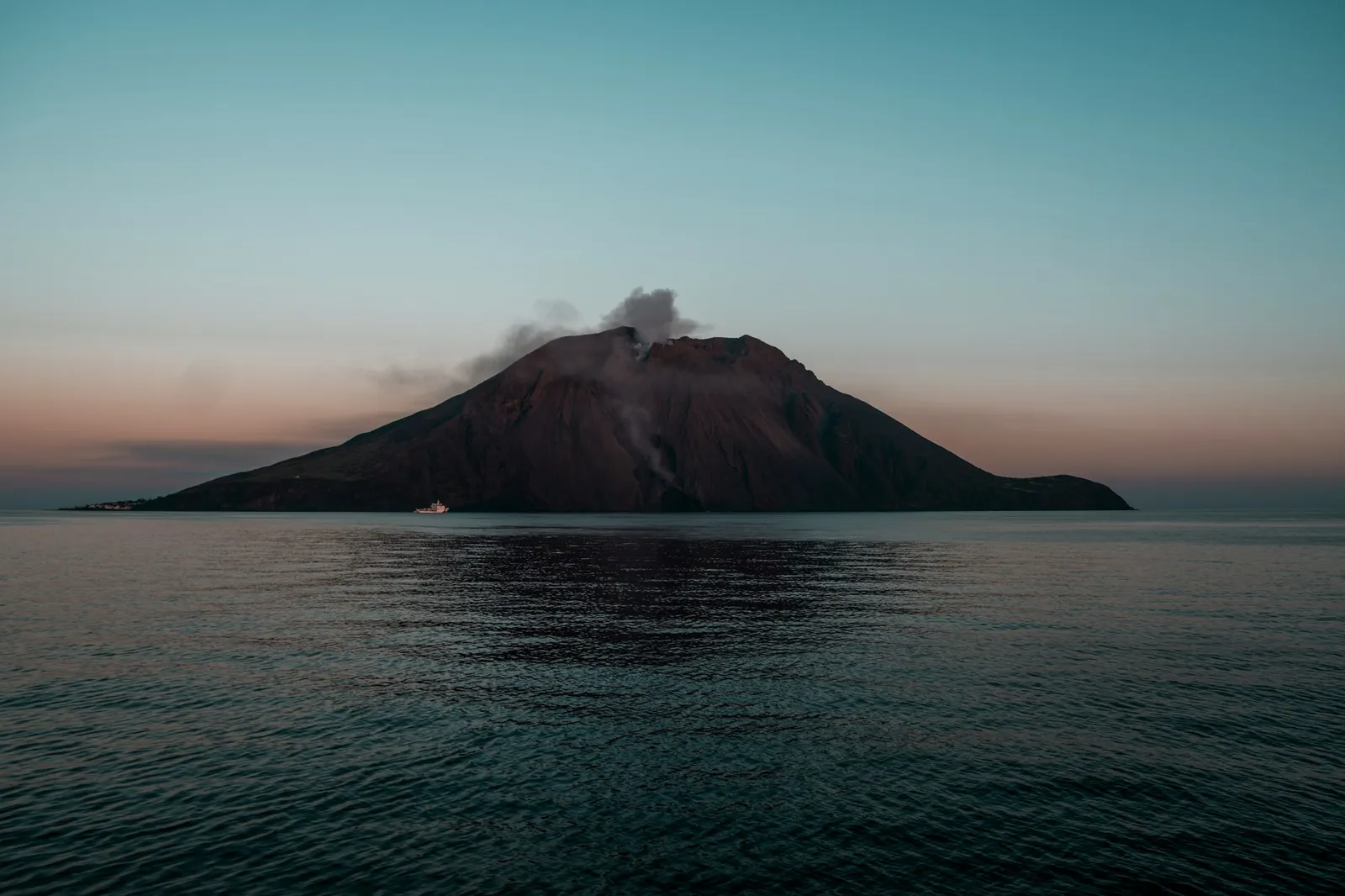
Stromboli is the island volcano at the northeast end of the Aeolian Islands, a near-perfect cone that rises 924 m (3,031 ft) out of the Tyrrhenian Sea. The Global Volcanism Program describes it as one of the most active volcanoes on Earth, in nearly constant activity for about 2,000 years, with eruptions recorded since 350 BCE. Its small explosions every few minutes, glowing at night, earned it the name "Lighthouse of the Mediterranean", and gave volcanologists the term "Strombolian" for that kind of eruption. The current period of activity has run since 1934.
Most of what it throws out falls back near the summit or rolls down the Sciara del Fuoco, a steep scar on the northwest side that runs straight into the sea. But Stromboli can also be violent. On 3 July 2019, INGV reports, a paroxysm sent an ash column about 2.5 miles (4 km) high, pyroclastic flows travelled about half a mile (1 km) out over the sea, and the falling hot material started fires on the slopes near the village of Ginostra. A 35-year-old hiker from Milazzo was killed near Punta dei Corvi. A second paroxysm followed on 28 August 2019.
Can you climb Stromboli?
Partly, and the rules depend on the volcano's alert level, so they change. Stromboli is part of the comune of Lipari, and its mayor sets the limits by order. The order in force when I wrote this, no. 16 of 5 May 2025, issued when the alert level went down from orange to yellow, allows:
- Anyone to walk up from the village of Stromboli to 290 m (950 ft).
- Hikers with an authorised guide to go up to 400 m (1,310 ft), in groups of no more than 25, and no more than 75 people above 290 m at a time.
- On the Ginostra side, anyone to walk up to 130 m (430 ft), and guided groups up to 400 m by the Punta dei Corvi path.
So the summit at 924 m is out of bounds, and anything above 290 m means a guide; my guide to hiking in Sicily sets the Stromboli walk alongside Etna and the island's other trails. Before you go, check the current order on the Comune di Lipari's site and the alert level with the Civil Protection Department; the island is also busy with boat trips from Milazzo and the other islands, which I cover in my guide to island hopping in Sicily.
You do not have to climb to see Stromboli erupt. In season, day boats from Lipari and Milazzo circle the island, and some stay out after dark so you can watch the glowing explosions from the sea, below the Sciara del Fuoco. My guide to the Aeolian Islands covers these boat trips. The same advice applies as on land: check the alert level with the Civil Protection Department before you book.
Vulcano
Vulcano is the southernmost of the Aeolian Islands, the closest to the Sicilian coast at Milazzo, and, as the Global Volcanism Program puts it, the island that gave us the word "volcano". The island is about 2 by 4 miles (3 by 7 km), and its active cone, La Fossa, rises to about 500 m (1,640 ft). Vulcanello, the little peninsula at its northern end, was a separate islet until it was joined to Vulcano around 1550.
La Fossa's last eruption, in the Program's list of eruptions, ran from 2 August 1888 to 22 March 1890, and the explosive "Vulcanian" style of eruption is named after the island. It has been quiet since, but not asleep: the Civil Protection Department raised Vulcano's alert level from green to yellow on 1 October 2021, after what INGV's Aeolian monitoring centre describes as a hydrothermal crisis, a change in the hot gases and fluids coming up through the crater. As with Stromboli, check the current level on the Civil Protection site before you plan a walk up the crater.
Lipari, Salina and the other Aeolian Islands
All of the Aeolian Islands are volcanic, which is why UNESCO added them to its World Heritage list in 2000: it calls them an outstanding record of island-building by volcanoes, and the islands that gave their names to two types of eruption, Vulcanian and Strombolian. Besides Stromboli and Vulcano, the group includes Lipari, the largest and the main port, Salina, Panarea, Filicudi and Alicudi.
Lipari's volcanic past is easy to see: the Global Volcanism Program places its latest eruption at Monte Pilato, on the island's northeast tip, where it formed the Rocche Rosse and Forgia Vecchia obsidian lava flows, and lists its last known eruption as 1230 CE. Salina, the greenest of the islands, is divided into three communes: Santa Marina Salina, Malfa and Leni. For ferries, hydrofoils and which island suits whom, see my guide to the Aeolian Islands.
Pantelleria
Pantelleria is a volcanic island in the Strait of Sicily, southwest of the main island, and part of the province of Trapani. The Global Volcanism Program describes it as a shield volcano, and its only confirmed eruption in historical times was not on the island at all: from 17 to 25 October 1891, a submarine eruption broke out about 2.5 miles (4 km) off its northwest coast. INGV's Catania observatory monitors Pantelleria along with Etna and the Aeolian Islands. The island has its own airport, which my guide to Sicily's airports includes.
Underwater volcanoes in the Strait of Sicily
Southwest of Sicily, between the island and Pantelleria, lies a field of submarine volcanoes that the Global Volcanism Program lists as the Campi Flegrei del Mar di Sicilia. Its shallowest point is only about 26 ft (8 m) below the surface, and the Program records eruptions there as far back as the First Punic War and again between the 17th and 20th centuries.
The best known came in 1831, when an eruption built a new island above the waves. It was called Ferdinandea, Graham Island or Île Julia depending on who was claiming it, and the Program notes that the navies of France, Britain, Spain and Italy all laid claim to it. It was an ephemeral island, as the Program calls it: it did not last, and the shallowest part of the field is now under the sea again.
How to follow Sicily's volcanoes
Two official sources, both in Italian, tell you what is happening now:
- INGV's Osservatorio Etneo, ct.ingv.it, monitors Etna, Stromboli, Vulcano and Pantelleria, with volcanic activity statements, weekly bulletins and webcams on the Aeolian Islands. Its blog, INGVvulcani, explains bigger events in plain language.
- The Civil Protection Department, rischi.protezionecivile.gov.it, publishes the alert level (green, yellow, orange or red) for Stromboli and Vulcano, which decides how far up you are allowed to walk.
If an Etna eruption worries you because of a flight, my guide to Etna eruptions and Catania flights explains what to check.
Frequently asked questions
How many volcanoes are in Sicily?
Etna is the only big volcano on the main island, but Sicily also includes the Aeolian Islands, which are all volcanic (Stromboli, Vulcano, Lipari, Salina, Panarea, Filicudi and Alicudi), the volcanic island of Pantelleria, and a field of submarine volcanoes in the Strait of Sicily. Etna and Stromboli are the ones that erupt often.
What are the active volcanoes in Sicily?
Etna and Stromboli erupt frequently. Vulcano last erupted in 1888 to 1890 but is closely watched, and its alert level was raised to yellow in October 2021. Pantelleria and the submarine volcanoes of the Strait of Sicily last erupted in 1891 and 1831. INGV in Catania monitors them all.
Is Stromboli in Sicily?
Yes. Stromboli is one of the Aeolian Islands, off the north coast of Sicily, in the province of Messina and the comune of Lipari. The islands are part of the Region of Sicily.
Can you climb Stromboli?
Only part of the way, under rules set by the mayor of Lipari that change with the alert level. Under the order of 5 May 2025, anyone could walk up to 290 m, and groups with an authorised guide could go to 400 m; the 924 m summit was closed. Check the current order before you go.
Why is Stromboli called the Lighthouse of the Mediterranean?
Because its small explosions, every few minutes and in nearly constant activity for about 2,000 years, glow at night and could be seen by sailors from far away.
Where does the word volcano come from?
From the island of Vulcano in the Aeolian Islands, which the Romans saw as the forge of Vulcan, their god of fire. Vulcanian eruptions are also named after it.
Is Mount Etna the only volcano in Sicily?
No. It is the only large volcano on the main island, but Stromboli, Vulcano, Lipari, Pantelleria and the submarine volcanoes of the Strait of Sicily all lie within Sicily or its waters.
Sources and small print
- Smithsonian Institution, Global Volcanism Program: Stromboli, Vulcano, Lipari, Pantelleria, Campi Flegrei del Mar di Sicilia and Etna
- INGV, Italy's national volcano institute: the paroxysm of Stromboli of 3 July 2019, and the Osservatorio Etneo, for the volcanoes' current state
- Comune di Lipari: order no. 16 of 5 May 2025 on access to Stromboli, as published by INGV's Centro di Monitoraggio delle Eolie, which also explains Vulcano's 2021 hydrothermal crisis
- Dipartimento della Protezione Civile: Vulcano (alert level raised to yellow on 1 October 2021)
- UNESCO World Heritage Centre: Isole Eolie (Aeolian Islands)
- For Etna, the sources on my Mount Etna page
The map is drawn from ISTAT's boundaries (openpolis, CC BY 4.0), with each volcano placed from its coordinates.
Credits
Photo: Salvatore Tonnara, Unsplash Licence, via Unsplash.
 The weekly YouTube series