
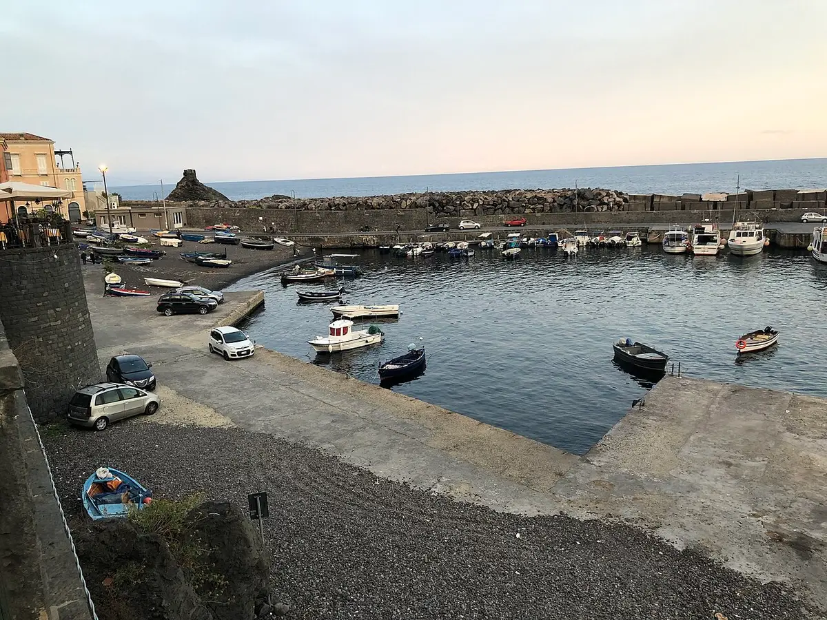
About Santa Maria la Scala
Santa Maria la Scala clusters around a small harbour, the Scalo Grande, at the bottom of the Timpa, a stratified lava cliff around 150 metres high with Acireale on top. The village has a seventeenth century church that gives it its name, a narrow seafront of late nineteenth century holiday villas, and a handful of fish restaurants.
The bathing is on a small beach of big lava pebbles polished by the waves, and on the black rocks and boulders that run along the shore. Fresh water from Etna's snowmelt runs underground through the lava and comes out at the shoreline, so the sea is clear and you will hit cold patches as you swim. At the southern end of the village is the Mulino di Miuccio, an old water mill fed by the Testa dell'Acqua spring that rises a few metres from the sea.
North of the village, reachable only from the sea, is the Grotta delle Palombe, a group of columnar basalts partly broken up by storms. The whole cliff behind is the Timpa nature reserve, set up in 1999, with Mediterranean scrub, lemon groves and old paths. Winter storms have damaged the village in the past, and the shore can change after big seas. There are no big lidos, little shade and limited parking.
How to get to Santa Maria la Scala
By car, follow the signs from Acireale down the winding road to Santa Maria la Scala, about 3 kilometres. Parking in the village is very limited in summer, so arrive early or walk.
On foot, the Chiazzette is an old stepped mule path paved with lava stone that zigzags down the Timpa from the SS114 on the edge of Acireale, through seven hairpins and a drop of about 150 metres. It takes around ten to twenty minutes down and half an hour back up in the heat.
By car down the road from Acireale to the village, or on foot down the stepped Chiazzette path through the Timpa reserve.
By car, Santa Maria la Scala is about 38 minutes from Catania Fontanarossa airport and 1 hour 58 minutes from Comiso airport.
Tips for visiting Santa Maria la Scala
- Walk down the Chiazzette in the morning and leave enough energy for the climb back.
- Bring water shoes for the pebbles and rocks.
- Expect cold currents where fresh springs meet the sea; refreshing in August.
- Have lunch at one of the trattorie by the harbour.
- Explore the Timpa reserve paths for views over the coast.
What is there
- No lidos or sunbed hire, with a free public stretch.
- Inside the Riserva Naturale Orientata La Timpa di Acireale: follow the reserve’s rules on access, fires, dogs and taking sand or shells.
- 6 public car parks mapped within 600 metres; in July and August they fill early.
Water quality at Santa Maria la Scala
The nearest official monitoring point, S. Maria La Scala, Testa Acqua, was rated excellent for bathing in the 2025 season under the EU Bathing Water Directive; it has varied over the years (2025 excellent, 2024 excellent, 2023 excellent, 2022 good, 2021 good).
- 2025Excellent
- 2024Excellent
- 2023Excellent
- 2022Good
- 2021Good
- 2020Excellent
- 2019Excellent
- 2018Excellent
Ratings run from excellent through good and sufficient to poor, and are set from four seasons of samples taken through each bathing season by the Italian health authorities and reported to the European Environment Agency.
Facts about Santa Maria la Scala
- The Chiazzette, a stepped path of lava stone, was for centuries the main route between Acireale and its harbour.
- The old Mulino di Miuccio water mill stands at the southern end of the village.
- The Timpa above the village was made a nature reserve in 1999.
- Fresh spring water from Etna flows into the sea along this shore, keeping it cool.
Acireale: the town
Acireale is a baroque city of about 50,600 people on a lava terrace above the Ionian Sea, between Catania and Etna, best known for one of Italy's great carnivals and for taking its granita very seriously. Read our guide to living in Acireale: house prices, the weather month by month, the nearest hospital and airports, history and food.
Beaches near Santa Maria la Scala
- Santa Tecla Acireale, 2 km, rocks
- Capo Mulini Acireale, 4 km, rocks
- Pozzillo Beach Acireale, 5 km, rocks and pebbles
- Aci Trezza Aci Castello, 6 km, rocks
- Aci Castello Aci Castello, 7 km, rocks
- Praiola Beach Riposto, 8 km, pebbles
- San Giovanni Li Cuti Beach Catania, 12 km, sand and rocks
- Fondachello Beach Mascali, 16 km, sand and pebbles
Frequently asked questions
What is the beach at Santa Maria la Scala like?
It is a small beach of large, smooth lava pebbles with black rocks and boulders along the rest of the shore. There is no sand to speak of. The water is clear and cool, and you get in over pebbles or from the rocks, so water shoes help.
How long is the walk down the Chiazzette to Santa Maria la Scala?
The path is a little under a kilometre with seven hairpin bends and a drop of about 150 metres. Allow ten to twenty minutes going down and around half an hour climbing back up. Wear proper shoes; the old paving can be slippery.
Why is the sea cold at Santa Maria la Scala?
Fresh water from Etna's snowmelt runs underground through the lava and comes out at the shoreline. Where it meets the sea you swim through distinctly cold patches, even in high summer.
Is there parking at Santa Maria la Scala?
There is some parking in and around the village, but the streets are narrow and spaces run out quickly on summer weekends and evenings, when people come down for fish restaurants. Walking down the Chiazzette avoids the problem.
Is the water clean at Santa Maria la Scala?
The nearest official monitoring point, S. Maria La Scala, Testa Acqua, was rated excellent for bathing in the 2025 season under the EU Bathing Water Directive; it has varied over the years (2025 excellent, 2024 excellent, 2023 excellent, 2022 good, 2021 good). Ratings are based on samples taken through the bathing season and checked for bacteria from sewage. After heavy rain, water near river mouths can be cloudy for a day or two.
Is Santa Maria la Scala sandy?
No, Santa Maria la Scala is rocks and pebbles. Bring water shoes and something to lie on.
Featured in
Credits
Photo: Davide Mauro, CC BY-SA 4.0, via Wikimedia Commons.
Written from 5 or more independent sources and checked. Figures: bathing water quality from the European Environment Agency (EU Bathing Water Directive), drive times and facilities from © OpenStreetMap contributors, map boundaries ISTAT via openpolis (CC BY 4.0).
Before you go: the latest sampling results and any bathing bans are on the Ministry of Health's Portale Acque, and local notices on the comune of Acireale's website.
 The weekly YouTube series