
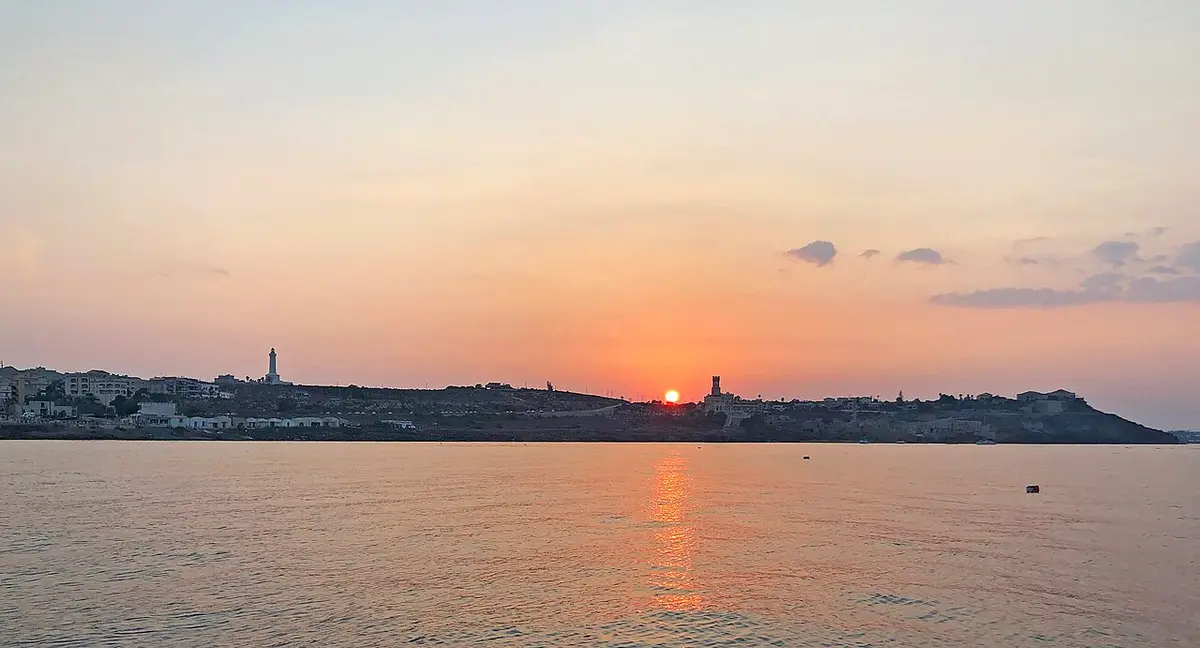
About Portopalo di Capo Passero
The town grew up around its tuna fishery and harbour. The church of San Gaetano was built between 1927 and 1931; after a fire in 2012 a new church of the Madonna Greca Eleusa was built in contemporary forms inspired by the sea. The Castello Tafuri, a 1935 villa on the point, is now a hotel, and the seventeenth century tonnara, worked until 1969, still has its loggia, furnace and stores, though it has long been closed and neglected. The writer Mario Soldati called it one of the most marvellous places he had ever seen.
The comune includes two islands. The Isola di Capo Passero, just offshore, has a Spanish fort of the seventeenth century and a lighthouse first lit in 1871. To the south-west, the Isola delle Correnti marks the meeting point of the Ionian and the Strait of Sicily, and at very low tide can be joined to the shore.
The fish market, built from 1977, is one of the main outlets for catches from the south-east, and fishing is still central to the economy. Since the 1990s intensive vegetable growing, including Pachino tomatoes, has spread across the farmland, and beach tourism fills the summer.
Living in Portopalo di Capo Passero
Portopalo is a holiday town in summer and a fishing village the rest of the year. There are many tourist beds for its size, so July and August are crowded and lively, while from November to March many beach businesses close. The population is stable and slightly growing, with a steady trickle of newcomers.
Basic shops, bars and the fish market cover daily life; Pachino next door has more choice, and Noto, Avola and Siracusa supply bigger shopping and services.
Pros: superb fish, clear sea on two coasts, long beaches and a real working harbour. Cons: a plain, sometimes untidy town, quiet winters with little open, and long drives to cities and airports.
A short history
People worked this coast since antiquity: at Scalo Mandrie, opposite the Isola di Capo Passero, are the tanks of a fish processing plant used for tuna and garum from the fifth century BC to the fifth century AD, with a small Christian catacomb nearby. The cape guarded busy sea lanes, and the Spanish built the island fort in the seventeenth century.
The present village began in 1792, when don Gaetano Deodato Moncada built about a hundred houses near the tuna fishery for some 300 farmers, shepherds and fishermen. It depended on Noto until 1816 and then on Pachino for more than a century and a half. On the night of 9 to 10 July 1943, British and Canadian troops landed on its shores in the first hours of the Allied invasion of Sicily.
Portopalo became a separate comune on 8 March 1975, adding di Capo Passero to its name. On the night of 25 to 26 December 1996 a boat carrying migrants from South Asia sank off its coast with the loss of 283 lives, one of the worst migrant tragedies in the post-war Mediterranean, remembered in the television film I fantasmi di Portopalo.
Food, festivals and traditions
This is a fish town first: tuna and whatever comes into the market that morning, cooked simply with Pachino tomatoes and local oil.
The patron, San Gaetano, is celebrated on 7 August with a procession and fireworks. On 19 March the feast of San Giuseppe is marked with the vampanigghia, a bonfire of branches lit at night, and on 17 January Sant'Antonio Abate was traditionally honoured with cuccìa and small blessed loaves.
Interesting facts about Portopalo di Capo Passero
- Portopalo lies further south than Tunis.
- Deep water off Capo Passero, around 3,500 metres down, hosts part of the KM3NeT undersea neutrino telescope.
- Fish tanks at Scalo Mandrie were used for tuna and garum for about a thousand years.
- The town became an independent comune in 1975.
House prices in Portopalo di Capo Passero
€680average price per m² to buy
€2.67average rent per m² a month
€68,000a 100 m² home at that price
These are the official averages from the Agenzia delle Entrate's property market observatory (OMI) for homes in normal condition across the town's 4 price zones. Prices in Portopalo di Capo Passero are close to the typical town in Siracusa province (€690 per m²) and above the typical Sicilian town (€593 per m²). Detached houses (villini) average about €721 per m².
Why these figures can look low: they come from the values on real sales, which sit below advertised asking prices, and the typical Sicilian town is the middle of all 391 comuni, most of them small inland towns. Island-wide averages quoted on property portals, around €1,100 to €1,300 per m², lean towards the cities and the coast, where most homes are listed. Rents work the same way: listings usually ask well above the official rent figure, often double or more.
Houses that need work, which is most of the cheap ones you see advertised, sell well below these figures. The renovation comes on top, so budget for both.
Work out the return on a let with the rental yield calculator, or see the steps from offer to keys in the buying timeline planner.
Getting there and getting around
| From the centre to | By car | Distance |
|---|---|---|
| Catania Fontanarossa airport (CTA) | 1 hour 36 minutes | 109 km |
| Comiso airport (CIY) | 1 hour 45 minutes | 87 km |
| Palermo Falcone Borsellino airport (PMO) | 4 hours 27 minutes | 337 km |
| Trapani Birgi airport (TPS) | 5 hours 25 minutes | 415 km |
| Palermo city centre | 3 hours 58 minutes | 305 km |
| Catania city centre | 1 hour 38 minutes | 113 km |
| Messina, for ferries to the mainland | 2 hours 42 minutes | 206 km |
| Nearest motorway or main road junction (Noto) | 43 minutes | 36 km |
| Nearest railway station (Rosolini) | 32 minutes | 25 km |
Times are by road on a clear day, worked out from OpenStreetMap. Allow longer in summer and on market days. Most people living in Portopalo di Capo Passero rely on a car; buses link the bigger towns but are infrequent on Sundays and in August.
Planning flights and trips? See the Schengen 90/180 calculator if you are from outside the EU.
Everyday life: shops, health and schools
- Hospital with A&E
- Ospedale Trigona, about 39 minutes by car
- Pharmacies in the comune
- 1
- Supermarkets
- 1
- Schools
- State: 1 nursery school, 1 primary school, 1 middle school
- Banks and cash machines
- 1
- Cafés and bars
- 12
- Restaurants
- 17
- Full fibre broadband
- 24.9% of addresses
Pharmacies and schools come from the official Ministry of Health and Ministry of Education lists. The other counts are of places mapped in OpenStreetMap inside the comune's boundary, so a small shop or a doctor's surgery can be missing. “Not fully mapped yet” means the volunteer map clearly has gaps here, not that the town has none. For a family doctor (medico di base, what the British call a GP), you register with the local health authority (ASP Siracusa) once you are resident.
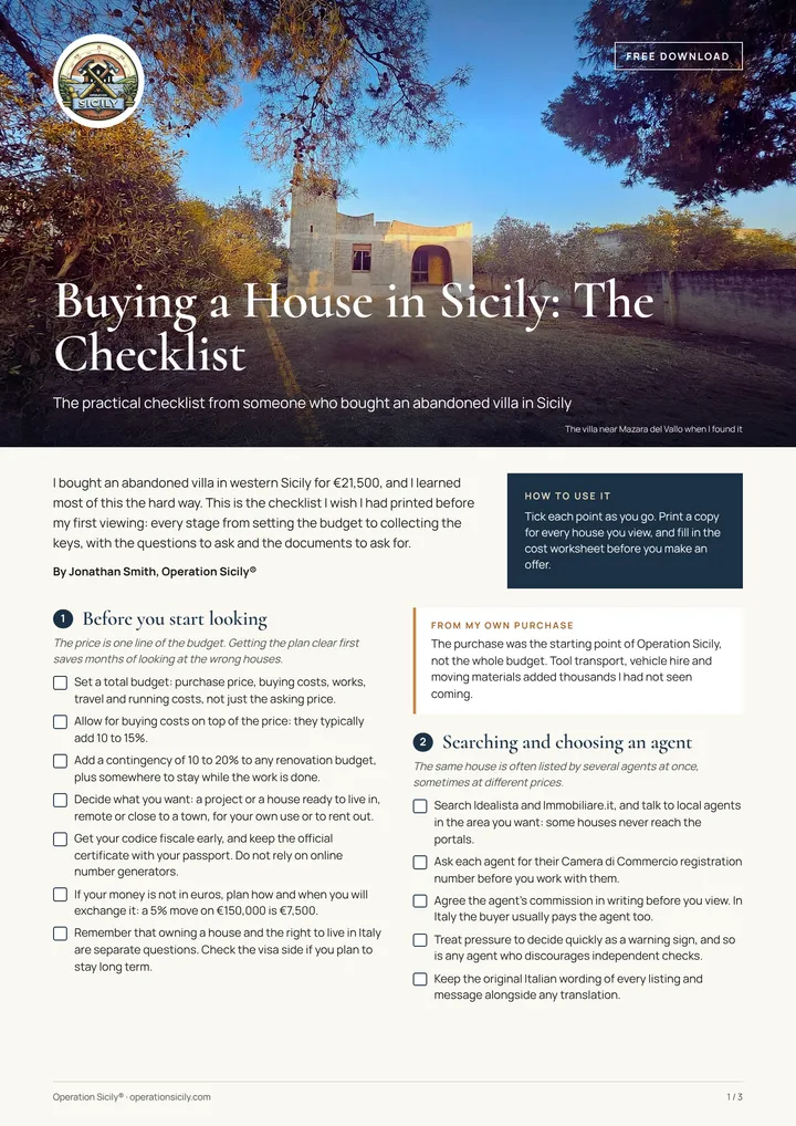
Free download
Buying a house in Sicily? Take my checklist.
Every step from budget to keys, the questions to ask at a viewing and the documents to ask for, as a PDF you can print.
Here is your checklist. Download the checklist (PDF)
Weather and climate in Portopalo di Capo Passero
30.9°Caverage July high
10.9°Caverage January low
447 mmrain a year, on about 65 days
19days a year above 30°C
| Month | Average temperature | Rain |
|---|---|---|
| January | 14°C | 57 mm |
| February | 14°C | 48 mm |
| March | 14°C | 39 mm |
| April | 16°C | 23 mm |
| May | 19°C | 14 mm |
| June | 23°C | 7 mm |
| July | 26°C | 5 mm |
| August | 27°C | 10 mm |
| September | 25°C | 44 mm |
| October | 22°C | 61 mm |
| November | 19°C | 75 mm |
| December | 16°C | 64 mm |
Averages for 2015 to 2024. Winters are mild, though stone houses still feel cold without heating. Summers are hot and dry.
See what each month brings in Sicily month by month, or size a solar system with the off-grid solar calculator.
Who lives there
- Population
- 3,877
- Change since 2019
- +0.8%
- Median age
- 43
- Foreign residents
- 153 (3.9%)
- People from Portopalo di Capo Passero are called
- portopalesi
Registered residents from abroad include 1 British, 1 German, 1 Belgian, 1 Irish, 1 Canadian, 2 Swiss, 6 Polish, 23 Romanian, 3 Albanian and 4 Ukrainian citizens. Most of the rest come from countries outside Europe and the Americas. Others own holiday homes here without registering as residents.
Portopalo di Capo Passero sees a fair number of visitors, with about 508 tourist beds, so it is livelier in summer, but it is a working town all year round.
Beaches in Portopalo di Capo Passero
Portopalo di Capo Passero has 2 beaches in our beach guide. 100% of its officially monitored bathing waters were rated excellent in the latest EU assessment.
- Isola delle Correnti Beach fine sand, water excellent
- Scalo Mandrie Beach sand and rocks, water excellent
Things to see and do in and around Portopalo di Capo Passero
Swim at the Isola delle Correnti and on the long beaches between Portopalo and Marzamemi, and from Scalo Mandrie look across to the island fort. Visit the fish market when the boats come in, see the old tonnara from the outside and the ancient fish tanks at Scalo Mandrie.
Marzamemi, the Vendicari reserve and Noto are close, and Pachino's wineries are next door.
- Capo Passero
- Isola di Capo Passero
- Correnti
- Cozzo Spadaro lighthouse
- Isola delle Correnti Lighthouse
Beaches within the comune include Spiaggia Isola delle Correnti.
Earthquake, landslide and flood risk
Portopalo di Capo Passero is in seismic zone 2, the second highest of Italy’s four seismic zones. The zone sets the anti-seismic standard for any new building, extension or structural renovation, which affects both the design and the cost. A structural survey is worth paying for before you buy any older building, stone house or flat.
0.4% of the comune's land is mapped by ISPRA as high or very high landslide hazard, where 1% of residents live, and no medium-probability flood areas are mapped. Ask for the hazard maps (PAI) for any house you are considering; the comune's technical office or your geometra can check them.
Check what you can build or change with the building permit checker, and keep a margin with the renovation contingency calculator.
The comune: useful details
- Official name
- Comune di Portopalo di Capo Passero
- Province
- Siracusa (Libero consorzio comunale di Siracusa)
- Postcode (CAP)
- 96010
- Dialling code
- 0931
- Area
- 14 km²
- Height above sea level
- 20 m
- ISTAT code
- 089020
- Cadastral code
- M257 (used in the codice fiscale of people born here)
- Official website
- comune.portopalo.sr.it
Registering as a resident, paying local taxes and building permits all go through the comune. If you were born abroad, get your Italian tax code first with the codice fiscale calculator.
Nearby towns
Portopalo di Capo Passero borders one other comune:
- Pachino €638/m²
Towns like Portopalo di Capo Passero elsewhere in Sicily
- Santo Stefano di Camastra (Messina province)
- Trappeto (Palermo province)
- Torrenova (Messina province)
- Siculiana (Agrigento province)
- Balestrate (Palermo province)
- Brolo (Messina province)
Portopalo di Capo Passero on our lists
See every town in Siracusa province (21 comuni), or let Find your town suggest places that match what you want.
Frequently asked questions
Where is Portopalo di Capo Passero in Sicily?
Portopalo di Capo Passero is in the province of Siracusa, about 45 km south of Siracusa. The centre sits about 20 metres above sea level and its land runs down to the coast.
What is Portopalo di Capo Passero known for?
Portopalo lies further south than Tunis. Deep water off Capo Passero, around 3,500 metres down, hosts part of the KM3NeT undersea neutrino telescope. Fish tanks at Scalo Mandrie were used for tuna and garum for about a thousand years.
Is Portopalo di Capo Passero a good place to live?
It depends what you want. Sea lovers, anglers and people who want a simple coastal life at the end of the island, with excellent fish and long empty beaches out of season. The nearest emergency department is about 39 minutes away, and homes average about €680 per m².
How much do houses cost in Portopalo di Capo Passero?
Official figures from the Agenzia delle Entrate put homes in Portopalo di Capo Passero at about €680 per square metre on average, so a 100 m² home in normal condition would be roughly €68,000. That is close to the typical town in the province (€690) and above the typical Sicilian town (€593). Houses needing work sell for less, and the best homes for more.
What is the nearest airport to Portopalo di Capo Passero?
Catania Fontanarossa airport is the nearest, about 1 hour 36 minutes away by car (109 km). Comiso is about 1 hour 45 minutes away. Times are for a clear road and will be longer in summer traffic.
What is the weather like in Portopalo di Capo Passero?
Summers are hot and dry: July afternoons average about 30.9°C, with around 19 days a year above 30°C. Winter nights in January average about 10.9°C. Rain totals about 447 mm a year, falling mostly between October and March.
How many people live in Portopalo di Capo Passero?
3,877 people live in the comune of Portopalo di Capo Passero, according to ISTAT. The population grew by 0.8% between 2019 and 2025. Half the residents are older than 43.
Is there a hospital near Portopalo di Capo Passero?
The nearest hospital with an emergency department (pronto soccorso) is Ospedale Trigona, about 39 minutes away by car. In an emergency anywhere in Italy, call 112.
Is Portopalo di Capo Passero in an earthquake zone?
Portopalo di Capo Passero is in seismic zone 2, the second highest of Italy’s four seismic zones. New building and structural work anywhere in Italy must follow anti-seismic rules, and the zone sets how strict they are, so ask your geometra or engineer to check any house you plan to buy or renovate.
Does Portopalo di Capo Passero count for the 7% flat tax for pensioners?
On population, yes: Portopalo di Capo Passero is a Sicilian town under the 30,000 resident limit for Italy's 7% flat tax for foreign pensioners. The other conditions are about you, not the town. Check the details with our 7% flat tax town checker and a qualified adviser.
Does Portopalo di Capo Passero have fast internet?
In parts. About 24.9% of addresses in Portopalo di Capo Passero can get full fibre (FTTH), according to AGCOM. Elsewhere, fibre to the cabinet, fixed wireless or 4G and 5G home broadband fill the gap. Check the exact address before you buy.
Can you walk to the Isola delle Correnti?
The island sits just off the beach, and only in particular low tide conditions does it become joined to the shore. Most of the time there is water between them, so check conditions on the day and take care, as the meeting of two seas brings currents.
Credits
Photo: Davide Mauro, CC BY-SA 4.0, via Wikimedia Commons.
Figures: ISTAT, Agenzia delle Entrate (OMI), Copernicus ERA5-Land, AGCOM, Dipartimento della Protezione Civile, ISPRA, Ministero della Salute, Ministero dell'Istruzione e del Merito, IndicePA, Open-Meteo, NASA POWER, Wikidata and © OpenStreetMap contributors, with several series gathered by the expatliving-data open data collection. Map boundaries ISTAT via openpolis (CC BY 4.0). Sicily as a whole: 4,787,390 people in 391 comuni.
 The weekly YouTube series