
About Scalo Mandrie Beach
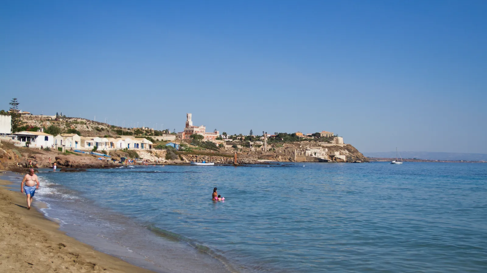
Scalo Mandrie is a small beach of about 150 metres at the foot of Portopalo di Capo Passero, the southernmost town on the main island of Sicily, close to the latitude of Tunis. It alternates patches of amber sand with low rocks and cliffs, so it has a different feel from the long sandy beaches nearby.
The water is clear and shallow close to the shore, with pebbles and rocks underfoot in places, and it deepens quickly a little way out. The rocky parts, with their small caves, are good for snorkelling.
The view is the reason to come. On one side stand the old tuna fishery of Portopalo and the Castello Tafuri; across the channel lies the Isola di Capo Passero, a low island more than a kilometre long with a Spanish fort built around the end of the sixteenth and start of the seventeenth century, a lighthouse and wide stretches of dwarf palm.
The tiny landing at Scalo Mandrie is where the summer boats leave for the island, which has its own small beach of sand among low dunes. The channel has strong currents, so the boat is the sensible way across.
How to get to Scalo Mandrie Beach
Scalo Mandrie is in Portopalo itself and is reached on foot from the town centre, down from the large panoramic square above the landing. Parking in the town is easiest near the harbour, about a kilometre away, in high summer.
Boats to the Isola di Capo Passero leave from the small landing during the summer season; ask on the spot about times.
Reached on foot from the centre of Portopalo, just below the panoramic square.
By car, Scalo Mandrie Beach is about 1 hour 40 minutes from Catania Fontanarossa airport and 1 hour 45 minutes from Comiso airport.
Tips for visiting Scalo Mandrie Beach
- Bring water shoes for the pebbles and rocks.
- Do not try to swim or wade across to the island; the currents in the channel are dangerous.
- Take a mask to look at the rocky seabed and caves.
- Walk up to the square above for the best view of the island at sunset.
What is there
- Lidos with sunbeds and umbrellas to rent, with a free public stretch.
- Toilets or showers mapped within 400 metres.
Water quality at Scalo Mandrie Beach
The nearest official monitoring point, Scalo Mandrie-Isola Capo Passero, was rated excellent for bathing in the 2025 season under the EU Bathing Water Directive, as it has been in each of the last 11 seasons.
- 2025Excellent
- 2024Excellent
- 2023Excellent
- 2022Excellent
- 2021Excellent
- 2020Excellent
- 2019Excellent
- 2018Excellent
Ratings run from excellent through good and sufficient to poor, and are set from four seasons of samples taken through each bathing season by the Italian health authorities and reported to the European Environment Agency.
Facts about Scalo Mandrie Beach
- Portopalo di Capo Passero is the southernmost town on the main island of Sicily.
- The Isola di Capo Passero has a Spanish era fort and a lighthouse.
- Dwarf palm, locally called scupazzu, covers much of the island.
- Summer boats to the island leave from the small landing at Scalo Mandrie.
Portopalo di Capo Passero: the town
Portopalo di Capo Passero is the southernmost comune on the island of Sicily, a fishing town of about 3,900 people where the Ionian Sea meets the Strait of Sicily, further south than Tunis. Read our guide to living in Portopalo di Capo Passero: house prices, the weather month by month, the nearest hospital and airports, history and food.
Beaches near Scalo Mandrie Beach
- Morghella Beach Pachino, 2 km, sand
- Isola delle Correnti Beach Portopalo di Capo Passero, 7 km, fine sand
- Carratois Beach Pachino, 7 km, fine sand
- Spinazza Beach Noto, 7 km, fine sand
- San Lorenzo Beach Noto, 9 km, fine sand
- Granelli Beach Pachino, 12 km, fine sand
- Vendicari Beach Noto, 13 km, fine sand
- Porto Ulisse Beach Ispica, 13 km, sand and rocks
Frequently asked questions
How do you get to the Isola di Capo Passero?
In summer, small boats cross from the landing at Scalo Mandrie in Portopalo. The channel is only a few hundred metres wide, but the currents are strong, so swimming or wading across is not a good idea. The island has a small sandy beach of its own.
Is Scalo Mandrie sandy?
Partly. It is a mix of amber sand and rocks, with pebbles in the shallows, rather than one smooth sandy beach. Water shoes make getting in more comfortable. For long sandy beaches, Carratois and the Isola delle Correnti are a short drive away.
What can you see from Scalo Mandrie Beach?
The Isola di Capo Passero with its fort and lighthouse straight ahead, and on the other side the old tuna fishery of Portopalo and the Castello Tafuri. It is one of the most scenic small beaches at the southern tip of Sicily.
Is the water clean at Scalo Mandrie Beach?
The nearest official monitoring point, Scalo Mandrie-Isola Capo Passero, was rated excellent for bathing in the 2025 season under the EU Bathing Water Directive, as it has been in each of the last 11 seasons. Ratings are based on samples taken through the bathing season and checked for bacteria from sewage. After heavy rain, water near river mouths can be cloudy for a day or two.
Credits
Photo: trolvag, CC BY-SA 3.0, via Wikimedia Commons.
Written from 4 or more independent sources and checked. Figures: bathing water quality from the European Environment Agency (EU Bathing Water Directive), drive times and facilities from © OpenStreetMap contributors, map boundaries ISTAT via openpolis (CC BY 4.0).
Before you go: the latest sampling results and any bathing bans are on the Ministry of Health's Portale Acque, and local notices on the comune of Portopalo di Capo Passero's website.
 The weekly YouTube series