
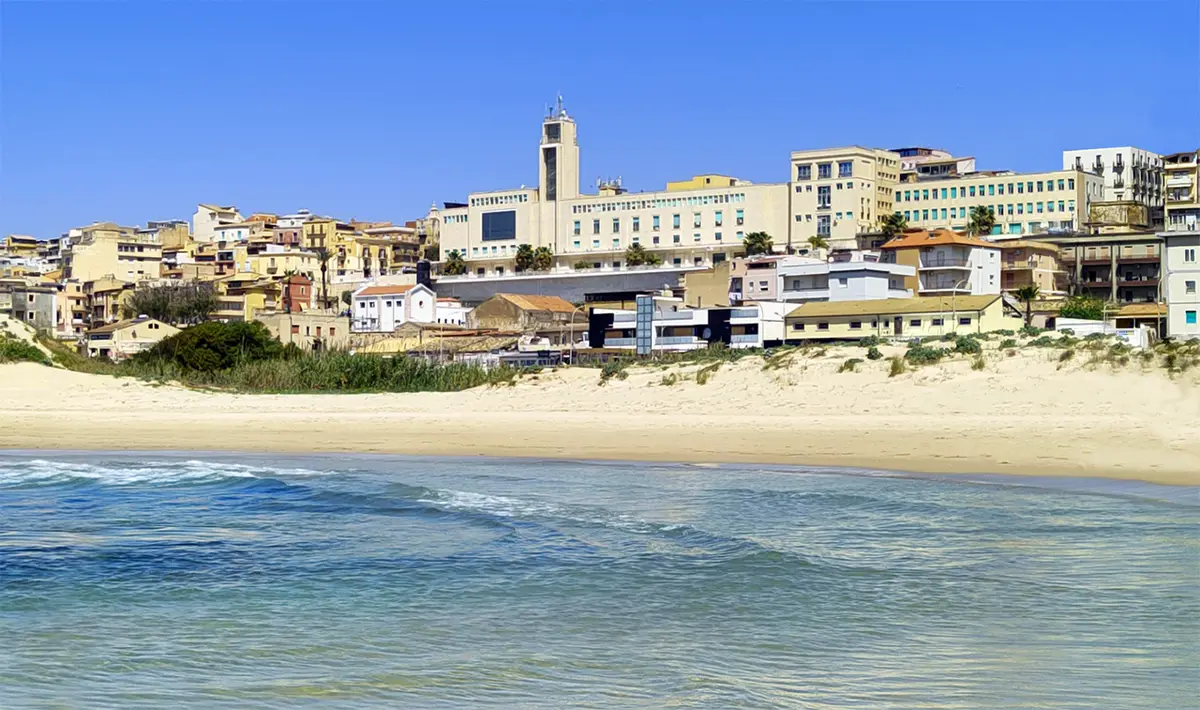
About Gela Beach
The beach runs for several kilometres east and west of Gela's tourist harbour, from the mouth of the Maroglio river in the east to the Gattano stream in the west, taking in the beach of Macchitella. It is a long, low shore of fine golden sand with shallow, sandy seabeds.
The eastern section is protected by breakwaters. Most of the beach is free, with lidos offering cabins, sunbeds, umbrellas, bars and restaurants along the way. The promenade, the Lungomare Federico II di Svevia, is lined with bars and ice cream parlours and is at its liveliest in the evening.
The Gulf of Gela is the widest bay in Sicily, stretching from Licata to Punta Braccetto. On the night of 9 to 10 July 1943 it was one of the main landing grounds of Operation Husky, and the battle of Gela that followed was among the first big actions of the Allied invasion.
How to get to Gela Beach
Gela lies on the SS115 between Licata and Vittoria. Follow the signs for the Lungomare, where there is parking along the seafront and in the streets behind.
The promenade is the obvious place to start: walk along it and choose your stretch of sand.
Level access from the Lungomare Federico II di Svevia promenade in front of the town.
By car, Gela Beach is about 1 hour from Comiso airport and 1 hour 34 minutes from Catania Fontanarossa airport.
Tips for visiting Gela Beach
- Walk the promenade at sunset, when the town comes out.
- Head west towards Macchitella or on to Manfria for quieter, more natural sand.
- Bring shade if you use the free stretches.
- Lower your expectations of the seafront buildings and enjoy the sand and the sea.
What is there
- Lidos with sunbeds and umbrellas to rent, with a free public stretch.
- 9 public car parks mapped within 600 metres; in July and August they fill early.
Water quality at Gela Beach
The nearest official monitoring point, Lido Conchiglia, was rated excellent for bathing in the 2025 season under the EU Bathing Water Directive, as it has been in each of the last 11 seasons.
- 2025Excellent
- 2024Excellent
- 2023Excellent
- 2022Excellent
- 2021Excellent
- 2020Excellent
- 2019Excellent
- 2018Excellent
Ratings run from excellent through good and sufficient to poor, and are set from four seasons of samples taken through each bathing season by the Italian health authorities and reported to the European Environment Agency.
Facts about Gela Beach
- The town beach runs from the mouth of the Maroglio river to the Gattano stream.
- Breakwaters protect the eastern section.
- The Gulf of Gela is the widest gulf in Sicily.
- Gela was one of the main Allied landing areas of Operation Husky in July 1943.
Gela: the town
Gela is the largest town in the province of Caltanissetta, a seaside city of about 70,000 people on Sicily's south coast, founded by Greeks from Rhodes and Crete around 689 BC and the place where American troops came ashore in July 1943. Read our guide to living in Gela: house prices, the weather month by month, the nearest hospital and airports, history and food.
Beaches near Gela Beach
- Manfria Beach Gela, 10 km, sand
- Marina di Acate Beach Acate, 13 km, fine sand
- Falconara Beach Butera, 19 km, sand and rocks
- Scoglitti Beach Vittoria, 24 km, fine sand
- Kamarina Beach Ragusa, 28 km, fine sand
- Randello Beach Ragusa, 31 km, fine sand
- Punta Braccetto Beach Ragusa, 33 km, sand and rocks
- Mollarella Beach Licata, 33 km, fine sand
Frequently asked questions
Is Gela beach sandy?
Yes. It is a long, low beach of fine golden sand with shallow, sandy water, running for several kilometres either side of the harbour. The eastern part is protected by breakwaters.
Is Gela beach free?
Mostly. Much of the shore is free beach, with lidos renting sunbeds and umbrellas along the way. The promenade behind has bars, ice cream shops and restaurants.
Is there a better beach near Gela?
For a more natural setting, drive west to Manfria, a sandy beach backed by dunes and a sixteenth century watchtower, about 12 kilometres from the centre. Falconara, further west towards Licata, is another option.
Is the water clean at Gela Beach?
The nearest official monitoring point, Lido Conchiglia, was rated excellent for bathing in the 2025 season under the EU Bathing Water Directive, as it has been in each of the last 11 seasons. Ratings are based on samples taken through the bathing season and checked for bacteria from sewage. After heavy rain, water near river mouths can be cloudy for a day or two.
Credits
Photo: AbelDionis, CC0, via Wikimedia Commons.
Written from 5 or more independent sources and checked. Figures: bathing water quality from the European Environment Agency (EU Bathing Water Directive), drive times and facilities from © OpenStreetMap contributors, map boundaries ISTAT via openpolis (CC BY 4.0).
Before you go: the latest sampling results and any bathing bans are on the Ministry of Health's Portale Acque, and local notices on the comune of Gela's website.
 The weekly YouTube series