
About Manfria Beach
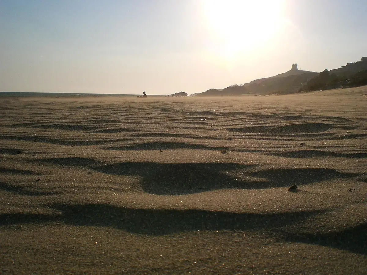
Manfria is a small seaside frazione of Gela about 12 kilometres from the town, facing the Gulf of Gela. Its beach of golden, straw coloured sand and clear water is backed by dunes and coastal scrub, and the landscape is still little built up.
Above the beach, on a promontory of gypsum rock with caves at its foot, stands the Torre di Manfria. Building began in 1549 under the viceroy Juan de Vega, was completed in 1578 to a design by the Florentine architect Camillo Camilliani, and the tower was largely rebuilt in the early seventeenth century. From the top you can see the whole sweep of the gulf.
The coast here is part of a Natura 2000 site, protected for its dunes and coastal habitats.
How to get to Manfria Beach
From Gela take the SS115 west towards Licata and follow the signs for Manfria. The road leads down to the beach, with parking nearby.
The tower stands on the headland above the beach and is easy to reach on foot.
Reached by road from Gela, with the sand a short walk from where you park.
By car, Manfria Beach is about 1 hour 9 minutes from Comiso airport and 1 hour 43 minutes from Catania Fontanarossa airport.
Tips for visiting Manfria Beach
- Bring an umbrella and water; the setting is natural and services are few.
- Walk up to the Torre di Manfria for the view over the gulf.
- Stay for sunset, which is one of the pleasures of this beach.
- Keep off the dunes to protect the plants that hold them together.
What is there
- Lidos: check locally, with a free public stretch.
- A public car park mapped within 600 metres; in July and August they fill early.
Water quality at Manfria Beach
The nearest official monitoring point, Lido Di Manfria, was rated excellent for bathing in the 2025 season under the EU Bathing Water Directive, as it has been in each of the last 11 seasons.
- 2025Excellent
- 2024Excellent
- 2023Excellent
- 2022Excellent
- 2021Excellent
- 2020Excellent
- 2019Excellent
- 2018Excellent
Ratings run from excellent through good and sufficient to poor, and are set from four seasons of samples taken through each bathing season by the Italian health authorities and reported to the European Environment Agency.
Facts about Manfria Beach
- Work on the Torre di Manfria began in 1549 and it was completed in 1578 to a design by Camillo Camilliani.
- The tower looks out over the whole Gulf of Gela.
- The coast at Manfria is part of a Natura 2000 site.
- Manfria lies about 12 kilometres from Gela.
Gela: the town
Gela is the largest town in the province of Caltanissetta, a seaside city of about 70,000 people on Sicily's south coast, founded by Greeks from Rhodes and Crete around 689 BC and the place where American troops came ashore in July 1943. Read our guide to living in Gela: house prices, the weather month by month, the nearest hospital and airports, history and food.
Beaches near Manfria Beach
- Falconara Beach Butera, 9 km, sand and rocks
- Gela Beach Gela, 10 km, fine sand
- Marina di Acate Beach Acate, 22 km, fine sand
- Mollarella Beach Licata, 24 km, fine sand
- Rocca San Nicola Beach Licata, 26 km, fine sand
- Scoglitti Beach Vittoria, 33 km, fine sand
- Kamarina Beach Ragusa, 36 km, fine sand
- Marina di Palma Beach Palma di Montechiaro, 39 km, sand and pebbles
Frequently asked questions
Is Manfria beach sandy?
Yes. It is a beach of golden sand backed by dunes and scrub, with clear water. It is more natural and less built up than the town beach in Gela.
How far is Manfria from Gela?
About 12 kilometres west of the town centre, reached by the SS115 towards Licata and the signposted turning for Manfria. There is parking close to the sand.
Can you visit the Torre di Manfria?
You can walk up to the headland where the sixteenth century watchtower stands and enjoy the view over the Gulf of Gela. The tower was part of the Spanish coastal defence system against pirates.
Is the water clean at Manfria Beach?
The nearest official monitoring point, Lido Di Manfria, was rated excellent for bathing in the 2025 season under the EU Bathing Water Directive, as it has been in each of the last 11 seasons. Ratings are based on samples taken through the bathing season and checked for bacteria from sewage. After heavy rain, water near river mouths can be cloudy for a day or two.
Featured in
Credits
Photo: www.gironavigando.it, CC BY 3.0, via Wikimedia Commons.
Written from 4 or more independent sources and checked. Figures: bathing water quality from the European Environment Agency (EU Bathing Water Directive), drive times and facilities from © OpenStreetMap contributors, map boundaries ISTAT via openpolis (CC BY 4.0).
Before you go: the latest sampling results and any bathing bans are on the Ministry of Health's Portale Acque, and local notices on the comune of Gela's website.
 The weekly YouTube series