
About Rocca San Nicola Beach
The beach of the Rocca di San Nicola and the Pisciotto runs along the coast west of Licata, a long stretch of fine sand. The islet that gives it its name, A' Rocca di Santu Cola in Sicilian, is little more than a large rock, separated from the shore by only about 120 metres of water.
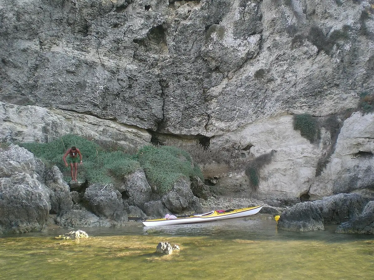
The islet is covered in typical Mediterranean scrub and is home to gulls and pigeons. Behind part of the beach rises a wall of sandstone covered in places by thick reed beds. Nearby, small coves such as Cala Paradiso are tucked under the rocky cliffs.
In the night of 10 July 1943 Rocca San Nicola was one of the four beaches in the Licata sector where Allied forces came ashore at the start of Operation Husky.
How to get to Rocca San Nicola Beach
From Licata take the SS115 west and follow the turnings for Mollarella and then Rocca San Nicola. The beach lies a little beyond Mollarella along the coast.
The smaller coves nearby, such as Cala Paradiso, are reached on rough unpaved tracks and a short walk.
Reached by road west of Mollarella, with the sand a short walk from where you park.
By car, Rocca San Nicola Beach is about 1 hour 42 minutes from Comiso airport and 2 hours 17 minutes from Catania Fontanarossa airport.
Tips for visiting Rocca San Nicola Beach
- Pick a calm day without wind if you want to swim to the islet.
- Bring a mask; the rocky seabed round the islet is worth exploring.
- Bring shade, as the beach is natural and open.
- Combine it with a look at Mollarella next door.
What is there
- Lidos: check locally, with a free public stretch.
Water quality at Rocca San Nicola Beach
The nearest official monitoring point, Pisciotto, was rated excellent for bathing in the 2025 season under the EU Bathing Water Directive, as it has been in each of the last 11 seasons.
- 2025Excellent
- 2024Excellent
- 2023Excellent
- 2022Excellent
- 2021Excellent
- 2020Excellent
- 2019Excellent
- 2018Excellent
Ratings run from excellent through good and sufficient to poor, and are set from four seasons of samples taken through each bathing season by the Italian health authorities and reported to the European Environment Agency.
Facts about Rocca San Nicola Beach
- The Rocca San Nicola islet lies about 120 metres off the beach.
- The islet is covered in Mediterranean scrub and inhabited by gulls and pigeons.
- Its Sicilian name is A' Rocca di Santu Cola.
- It was one of the four Licata landing beaches of Operation Husky in 1943.
Licata: the town
Licata is a port town of about 34,000 people at the mouth of the Salso river, at the western end of the Gulf of Gela, with liberty-style palaces from its sulphur boom and a run of coves and beaches along its western coast. Read our guide to living in Licata: house prices, the weather month by month, the nearest hospital and airports, history and food.
Beaches near Rocca San Nicola Beach
- Mollarella Beach Licata, 2 km, fine sand
- Marina di Palma Beach Palma di Montechiaro, 14 km, sand and pebbles
- Falconara Beach Butera, 17 km, sand and rocks
- Cala Vincenzina Palma di Montechiaro, 18 km, sand
- Punta Bianca Beach Agrigento, 20 km, sand and pebbles
- Manfria Beach Gela, 26 km, sand
- San Leone Beach Agrigento, 29 km, fine sand
- Gela Beach Gela, 35 km, fine sand
Frequently asked questions
Can you swim to Rocca San Nicola?
Strong swimmers do on calm days, as the islet is only around 120 metres from the shore and the water is clear. Do not attempt it in wind or waves, and remember that there are no lifeguards on this stretch.
Is Rocca San Nicola beach sandy?
Yes. It is a long beach of fine sand facing the islet, with rocks around the islet itself that are good for snorkelling. Small sandy coves lie close by under the cliffs.
Where is Rocca San Nicola beach?
On the coast of Licata in the province of Agrigento, a little west of Mollarella. It is reached from the SS115 by the turnings for Mollarella and Rocca San Nicola.
Is the water clean at Rocca San Nicola Beach?
The nearest official monitoring point, Pisciotto, was rated excellent for bathing in the 2025 season under the EU Bathing Water Directive, as it has been in each of the last 11 seasons. Ratings are based on samples taken through the bathing season and checked for bacteria from sewage. After heavy rain, water near river mouths can be cloudy for a day or two.
Featured in
Credits
Photo: www.gironavigando.it, CC BY 3.0, via Wikimedia Commons.
Written from 4 or more independent sources and checked. Figures: bathing water quality from the European Environment Agency (EU Bathing Water Directive), drive times and facilities from © OpenStreetMap contributors, map boundaries ISTAT via openpolis (CC BY 4.0).
Before you go: the latest sampling results and any bathing bans are on the Ministry of Health's Portale Acque, and local notices on the comune of Licata's website.
 The weekly YouTube series