
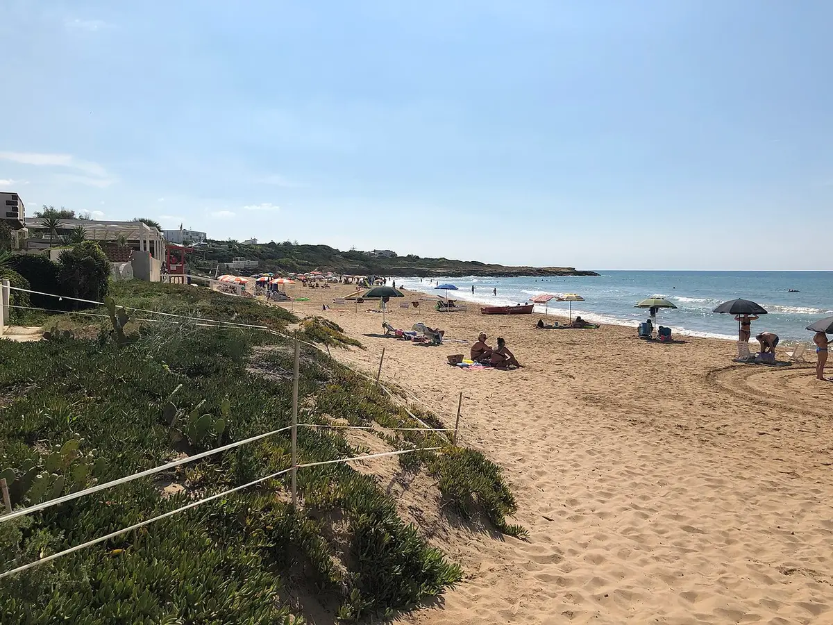
About Punta Braccetto Beach
The beach at Punta Braccetto is fine golden sand broken by stretches of rock and small cliffs. The sandy parts shelve gently, while off the rocky points the water deepens quickly, which makes it a good place to swim with a mask.
The village straddles the boundary between the comuni of Ragusa and Santa Croce Camerina. It is a place of campsites, holiday homes and a few bars and restaurants rather than a town, and several campsites open straight onto the sand.
At the end of the rocky arm known as the Braccio della Colombara stand the remains of the Torre Vigliena, a coastal watchtower built between 1595 and 1607 to warn of pirate raids. It was in sight of the towers at Torre di Mezzo and Punta Secca.
Just to the west begins the pine forest and long wild beach of Randello.
How to get to Punta Braccetto Beach
From Santa Croce Camerina follow the signs to Punta Braccetto for about 6 km towards the coast. Parking is a mix of free roadside spaces and paid areas; arrive early in July and August, when the village is full.
From Marina di Ragusa, drive west along the coast road through Punta Secca and Torre di Mezzo.
Level access from the village streets and campsites that back onto the sand.
By car, Punta Braccetto Beach is about 44 minutes from Comiso airport and 2 hours 3 minutes from Catania Fontanarossa airport.
Tips for visiting Punta Braccetto Beach
- Bring a mask: the rocky edges are the best part of the bay for snorkelling.
- Walk out to the ruins of Torre Vigliena for the view along the coast.
- Weekdays are much calmer than weekends in high summer.
- For a wilder beach, Randello's pine fringed sand is just to the west.
What is there
- Lidos with sunbeds and umbrellas to rent, with a free public stretch.
- 2 public car parks mapped within 600 metres; in July and August they fill early.
Facts about Punta Braccetto Beach
- Punta Braccetto straddles the boundary between the comuni of Ragusa and Santa Croce Camerina.
- The Torre Vigliena watchtower was built between 1595 and 1607 at the tip of the Braccio della Colombara.
- The tower was part of a chain in sight of each other along the coast, including Torre di Mezzo and Torre Scalambri at Punta Secca.
Ragusa: the town
Ragusa is the capital of its province, a growing city of about 74,000 people in the southern Monti Iblei, Italy's southernmost provincial capital, made of two towns: baroque Ragusa Ibla on its hill and the eighteenth century upper town on the plateau, with Marina di Ragusa on the coast. Read our guide to living in Ragusa: house prices, the weather month by month, the nearest hospital and airports, history and food.
Beaches near Punta Braccetto Beach
- Randello Beach Ragusa, 2 km, fine sand
- Punta Secca Beach Santa Croce Camerina, 4 km, sand and rocks
- Caucana Beach Santa Croce Camerina, 5 km, fine sand
- Kamarina Beach Ragusa, 6 km, fine sand
- Scoglitti Beach Vittoria, 9 km, fine sand
- Marina di Ragusa Beach Ragusa, 10 km, fine sand
- Irminio River Beach Ragusa, 12 km, fine sand
- Playa Grande Beach Scicli, 13 km, fine sand
Frequently asked questions
Is Punta Braccetto good for snorkelling?
Yes, around the rocky points. The bay is sandy in the middle, but the rocks and low cliffs at either end drop into deeper, clear water, which is where to go with a mask and snorkel on a calm day.
Is Punta Braccetto beach free?
There are free stretches of sand as well as lidos renting sunbeds and umbrellas, and several campsites that front the beach. You can simply walk down from the village with your own kit.
Which comune is Punta Braccetto in?
Both. The village straddles the boundary between Ragusa and Santa Croce Camerina, so some houses stand in one comune and some in the other.
How busy is Punta Braccetto in summer?
In July and August it is very popular with families and campers and gets crowded, especially at weekends. In June and September it is far quieter and the bay is at its best.
Is Punta Braccetto Beach sandy?
No, Punta Braccetto Beach is sand and rocks. Bring water shoes and something to lie on.
Featured in
Credits
Photo: Davide Mauro, CC BY-SA 4.0, via Wikimedia Commons.
Written from 4 or more independent sources and checked. Figures: bathing water quality from the European Environment Agency (EU Bathing Water Directive), drive times and facilities from © OpenStreetMap contributors, map boundaries ISTAT via openpolis (CC BY 4.0).
Before you go: the latest sampling results and any bathing bans are on the Ministry of Health's Portale Acque, and local notices on the comune of Ragusa's website.
 The weekly YouTube series