
About Sant'Angelo Muxaro
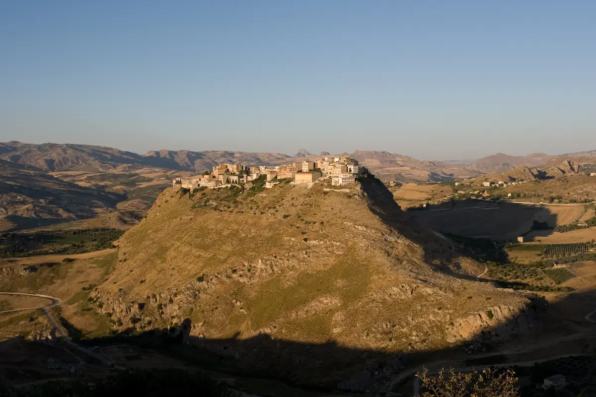
The village stands at 335 metres on a gypsum hill dominating the middle Platani valley. Its slopes are lined with rock-cut tombs, small and large, among them the monumental Tomba del Principe, and there are further necropolises at Colle Sant'Angelo and the Grotticelle, as well as the ruins of a medieval castle. Finds from the tombs are in the museums of Syracuse and Agrigento, and the village has its own archaeological museum, MuSAM, opened in December 2015.
The Grotta di Sant'Angelo Muxaro, also called Grotta Ciavuli, is a karst cave protected as a nature reserve and listed as a geosite of national interest.
Living in Sant'Angelo Muxaro
Tourism is modest and the village is quiet all year, with an ageing population that has fallen by nearly a tenth in a decade. Services are minimal; Raffadali, Aragona and Agrigento provide shops, schools and offices.
Pros: peace, very low costs and remarkable surroundings. Cons: few amenities and jobs, and parts of the inhabited area are classed at risk of landslides.
A short history
An important native village grew here from about the thirteenth century BC and, in the eighth and seventh centuries BC, traded with the first Greek settlers. Some historians identify nearby Monte Castello with Kamikos, capital of the Sicani king Kokalos, where King Minos is said to have died while pursuing Daedalus; others place it elsewhere. A gold bowl from the tombs, decorated with striding bulls, is now in the British Museum.
In the early sixteenth century Albanian refugees fleeing the Ottoman advance settled the present village and kept the Greek Byzantine rite for a time, until they were gradually absorbed. The barony later belonged to the Tagliavia d'Aragona and the Pignatelli until feudalism ended in 1812.
Food, festivals and traditions
Farming here means wheat, olives, almonds and sheep, and the territory lies within the Raffadali pistachio DOP zone. The patron is Saint Angelo of Jerusalem, to whom the Chiesa Madre is dedicated.
Interesting facts about Sant'Angelo Muxaro
- Some historians identify the area with Kamikos, the legendary capital of King Kokalos.
- A gold bowl from the village's tombs is in the British Museum.
- The present village was settled by Albanian refugees in the early sixteenth century.
- The Grotta di Sant'Angelo Muxaro is a protected nature reserve.
House prices in Sant'Angelo Muxaro
The property market observatory publishes no average for Sant'Angelo Muxaro, which usually means too few sales to give a reliable figure. Homes here are typically priced in line with the smaller towns of Agrigento province.
Getting there and getting around
| From the centre to | By car | Distance |
|---|---|---|
| Catania Fontanarossa airport (CTA) | 2 hours 29 minutes | 174 km |
| Palermo Falcone Borsellino airport (PMO) | 2 hours 44 minutes | 155 km |
| Comiso airport (CIY) | 2 hours 48 minutes | 150 km |
| Trapani Birgi airport (TPS) | 3 hours 7 minutes | 169 km |
| Palermo city centre | 2 hours 15 minutes | 123 km |
| Catania city centre | 2 hours 28 minutes | 175 km |
| Messina, for ferries to the mainland | 3 hours 34 minutes | 268 km |
| Nearest motorway or main road junction (Fontanelle, Zona Industriale) | 33 minutes | 29 km |
| Nearest railway station (Aragona Caldare) | 29 minutes | 23 km |
Times are by road on a clear day, worked out from OpenStreetMap. Allow longer in summer and on market days. Most people living in Sant'Angelo Muxaro rely on a car; buses link the bigger towns but are infrequent on Sundays and in August.
Planning flights and trips? See the Schengen 90/180 calculator if you are from outside the EU.
Everyday life: shops, health and schools
- Hospital with A&E
- Ospedale San Giovanni di Dio, about 36 minutes by car
- Pharmacies in the comune
- 1
- Supermarkets
- None mapped in the comune; the nearest is 19 minutes away
- Schools
- State: 1 nursery school, 1 primary school, 1 middle school
- Banks and cash machines
- None mapped
- Cafés and bars
- None mapped
- Restaurants
- None mapped
- Full fibre broadband
- 75.2% of addresses
Pharmacies and schools come from the official Ministry of Health and Ministry of Education lists. The other counts are of places mapped in OpenStreetMap inside the comune's boundary, so a small shop or a doctor's surgery can be missing. “Not fully mapped yet” means the volunteer map clearly has gaps here, not that the town has none. For a family doctor (medico di base, what the British call a GP), you register with the local health authority (ASP Agrigento) once you are resident.
Free download
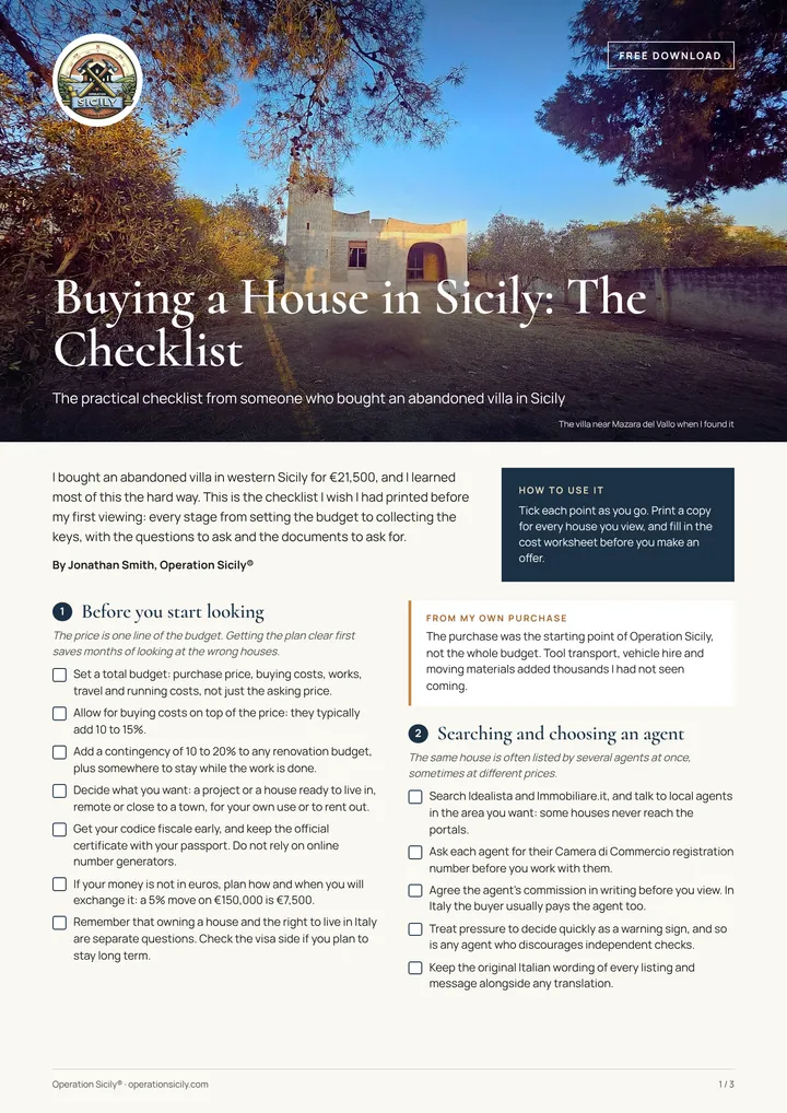
Buying a house in Sicily? Take my checklist.
Every step from budget to keys, the questions to ask at a viewing and the documents to ask for, as a PDF you can print.
Here is your checklist. Download the checklist (PDF)
Weather and climate in Sant'Angelo Muxaro
31.7°Caverage July high
4.3°Caverage January low
522 mmrain a year, on about 82 days
62days a year above 30°C
| Month | Average temperature | Rain |
|---|---|---|
| January | 9°C | 72 mm |
| February | 9°C | 61 mm |
| March | 11°C | 56 mm |
| April | 14°C | 39 mm |
| May | 18°C | 18 mm |
| June | 23°C | 15 mm |
| July | 27°C | 5 mm |
| August | 27°C | 9 mm |
| September | 23°C | 41 mm |
| October | 19°C | 66 mm |
| November | 14°C | 70 mm |
| December | 10°C | 69 mm |
Averages for 2015 to 2024. Winters are cool and damp, and you will want heating for three or four months. Summers are hot and dry.
See what each month brings in Sicily month by month, or size a solar system with the off-grid solar calculator.
Who lives there
- Population
- 1,146
- Change since 2019
- -9.5%
- Median age
- 53
- Foreign residents
- 38 (3.3%)
Registered residents from abroad include 3 American, 1 French, 1 Belgian, 9 Romanian and 3 Ukrainian citizens. Most of the rest come from countries outside Europe and the Americas.
Sant'Angelo Muxaro lives mainly for its own residents rather than for visitors, with only about 44 tourist beds, so everyday life changes little between summer and winter.
Beaches near Sant'Angelo Muxaro
- Siculiana Marina Beach Siculiana, 21 km, sand, water excellent
- Giallonardo Beach Realmonte, 21 km, sand, water excellent
- Torre Salsa Beach Siculiana, 22 km, sand
- Capo Rossello Beach Realmonte, 22 km, sand, water excellent
Things to see and do in and around Sant'Angelo Muxaro
Visit MuSAM, then walk the slopes to the Tomba del Principe and the other rock tombs, with wide views over the Platani. San Biagio Platani's Easter arches are nearby.
The quickest beach to reach by car, Spiaggia del Caos, is about 37 minutes away.
Earthquake, landslide and flood risk
Sant'Angelo Muxaro is in seismic zone 2, the second highest of Italy’s four seismic zones. The zone sets the anti-seismic standard for any new building, extension or structural renovation, which affects both the design and the cost. A structural survey is worth paying for before you buy any older building, stone house or flat.
2% of the comune's land is mapped by ISPRA as high or very high landslide hazard, where 9.4% of residents live, and no medium-probability flood areas are mapped. Ask for the hazard maps (PAI) for any house you are considering; the comune's technical office or your geometra can check them.
Check what you can build or change with the building permit checker, and keep a margin with the renovation contingency calculator.
The comune: useful details
- Official name
- Comune di Sant'Angelo Muxaro
- Province
- Agrigento (Libero consorzio comunale di Agrigento)
- Postcode (CAP)
- 92020
- Dialling code
- 0922
- Area
- 63 km²
- Height above sea level
- 335 m
- ISTAT code
- 084039
- Cadastral code
- I290 (used in the codice fiscale of people born here)
- Official website
- comune.santangelomuxaro.ag.it
Registering as a resident, paying local taxes and building permits all go through the comune. If you were born abroad, get your Italian tax code first with the codice fiscale calculator.
Nearby towns
Sant'Angelo Muxaro borders 9 other comuni:
- Agrigento €876/m²
- Alessandria della Rocca €400/m²
- Aragona €500/m²
- Casteltermini €507/m²
- Cattolica Eraclea €525/m²
- Cianciana €500/m²
- Raffadali €525/m²
- San Biagio Platani €363/m²
- Santa Elisabetta
Towns like Sant'Angelo Muxaro elsewhere in Sicily
- Roccavaldina (Messina province)
- Graniti (Messina province)
- Montagnareale (Messina province)
- Savoca (Messina province)
- Pettineo (Messina province)
- Militello Rosmarino (Messina province)
See every town in Agrigento province (43 comuni), or let Find your town suggest places that match what you want.
Frequently asked questions
Where is Sant'Angelo Muxaro in Sicily?
Sant'Angelo Muxaro is in the province of Agrigento, about 20 km north of Agrigento. The centre sits about 335 metres above sea level.
What is Sant'Angelo Muxaro known for?
Some historians identify the area with Kamikos, the legendary capital of King Kokalos. A gold bowl from the village's tombs is in the British Museum. The present village was settled by Albanian refugees in the early sixteenth century.
Is Sant'Angelo Muxaro a good place to live?
It depends what you want. A rewarding place for buyers who want deep quiet and ancient history, with Agrigento near enough for everyday needs. The nearest emergency department is about 36 minutes away.
What is the nearest airport to Sant'Angelo Muxaro?
Catania Fontanarossa airport is the nearest, about 2 hours 29 minutes away by car (174 km). Palermo Falcone Borsellino is about 2 hours 44 minutes away. Times are for a clear road and will be longer in summer traffic.
What is the weather like in Sant'Angelo Muxaro?
Summers are hot and dry: July afternoons average about 31.7°C, with around 62 days a year above 30°C. Winter nights in January average about 4.3°C. Rain totals about 522 mm a year, falling mostly between October and March.
How many people live in Sant'Angelo Muxaro?
1,146 people live in the comune of Sant'Angelo Muxaro, according to ISTAT. The population fell by 9.5% between 2019 and 2025. Half the residents are older than 53.
Is there a hospital near Sant'Angelo Muxaro?
The nearest hospital with an emergency department (pronto soccorso) is Ospedale San Giovanni di Dio, about 36 minutes away by car. In an emergency anywhere in Italy, call 112.
Is Sant'Angelo Muxaro in an earthquake zone?
Sant'Angelo Muxaro is in seismic zone 2, the second highest of Italy’s four seismic zones. New building and structural work anywhere in Italy must follow anti-seismic rules, and the zone sets how strict they are, so ask your geometra or engineer to check any house you plan to buy or renovate.
Does Sant'Angelo Muxaro count for the 7% flat tax for pensioners?
On population, yes: Sant'Angelo Muxaro is a Sicilian town under the 30,000 resident limit for Italy's 7% flat tax for foreign pensioners. The other conditions are about you, not the town. Check the details with our 7% flat tax town checker and a qualified adviser.
Does Sant'Angelo Muxaro have fast internet?
Yes, for most homes: about 75.2% of addresses in Sant'Angelo Muxaro can get full fibre (FTTH), according to the communications regulator AGCOM. Check the exact address before you buy.
Credits
Photo: Carlo Columba from Palermo, Italia, CC BY-SA 2.0, via Wikimedia Commons.
Figures: ISTAT, Agenzia delle Entrate (OMI), Copernicus ERA5-Land, AGCOM, Dipartimento della Protezione Civile, ISPRA, Ministero della Salute, Ministero dell'Istruzione e del Merito, IndicePA, Open-Meteo, NASA POWER, Wikidata and © OpenStreetMap contributors, with several series gathered by the expatliving-data open data collection. Map boundaries ISTAT via openpolis (CC BY 4.0). Sicily as a whole: 4,787,390 people in 391 comuni.
 The weekly YouTube series