
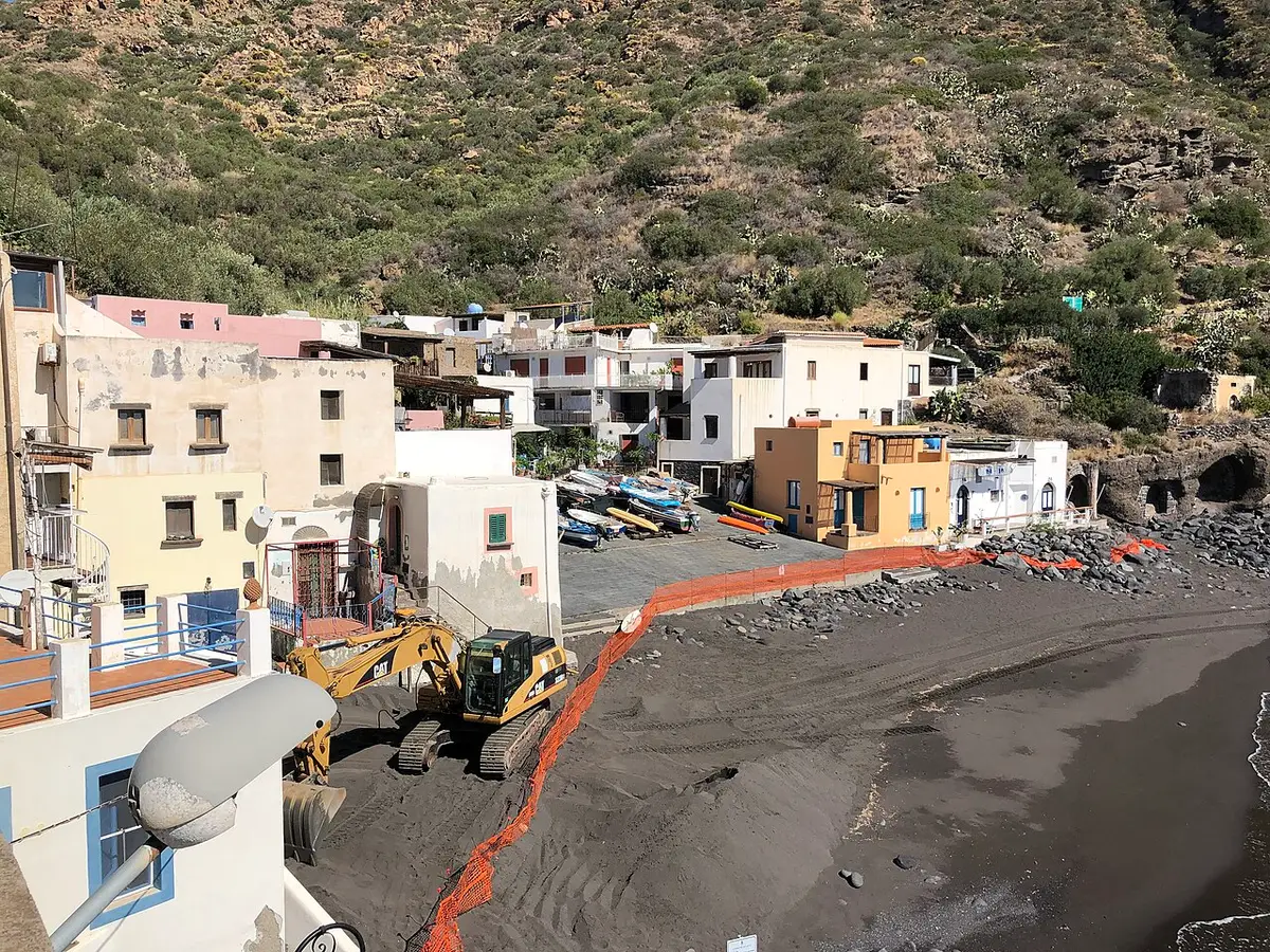
About Rinella Beach, Salina
Rinella is a small fishing village and harbour on the south coast of Salina, in the comune of Leni. Hydrofoils and ferries call here as well as at Santa Marina Salina, so for many visitors this is the first beach they see.
The beach is a crescent of black volcanic sand, the only real stretch of sand on the island. The seabed is shallow and sandy close to shore, so the sea is easy for children, and the rocks at the ends are good for a snorkel.
Around the bay, caves cut into the rock once sheltered the village's boats. The beach looks out towards Filicudi and Alicudi, and the sunsets over the sea are lovely. It can feel busy when a boat comes in, and the harbour sits right beside it, so it is not a place for total peace.
How to get to Rinella Beach, Salina
Hydrofoils and ferries from Milazzo and the other islands stop at Rinella, and the beach is a couple of minutes' walk from the quay. By road, Rinella is reached from Leni, and buses run across the island from Santa Marina Salina and Malfa.
If you are driving, parking in the village is limited in summer; it is simplest to come by bus or scooter.
Right beside the harbour at Rinella, where hydrofoils and ferries call, with level access from the village.
Rinella Beach, Salina is on one of Sicily’s small islands: see the Leni town page for ferries, hydrofoils and flights.
Tips for visiting Rinella Beach, Salina
- This is the best beach on Salina for small children because of the sand and shallow water.
- Black sand gets very hot, so bring sandals.
- Stay for the sunset over Filicudi and Alicudi.
- If you arrive or leave by hydrofoil from Rinella, it is an easy last swim before the boat.
What is there
- Lidos: check locally, with a free public stretch.
- 3 public car parks mapped within 600 metres; in July and August they fill early.
Water quality at Rinella Beach, Salina
The nearest official monitoring point, Salina Rinella, was rated excellent for bathing in the 2025 season under the EU Bathing Water Directive, as it has been in each of the last 11 seasons.
- 2025Excellent
- 2024Excellent
- 2023Excellent
- 2022Excellent
- 2021Excellent
- 2020Excellent
- 2019Excellent
- 2018Excellent
Ratings run from excellent through good and sufficient to poor, and are set from four seasons of samples taken through each bathing season by the Italian health authorities and reported to the European Environment Agency.
Facts about Rinella Beach, Salina
- Rinella has the only black sand beach on Salina.
- Rinella is Salina's second port, served by hydrofoils and ferries.
- Caves in the rock around the bay were once used to shelter fishing boats.
- The beach looks towards the islands of Filicudi and Alicudi.
Leni: the town
Leni is a village of about 680 people on Salina, the greenest of the Aeolian Islands, set in the saddle between its two old volcanoes, with the little port of Rinella below. Read our guide to living in Leni: house prices, the weather month by month, the nearest hospital and airports, history and food.
Beaches near Rinella Beach, Salina
- Lingua Beach, Salina Santa Marina Salina, 3 km, pebbles
- Scario Beach, Malfa Malfa, 4 km, pebbles
- Pollara Beach, Salina Malfa, 4 km, pebbles
- Acquacalda Beach, Lipari Lipari, 9 km, sand and pebbles
Frequently asked questions
Is there a sandy beach on Salina?
Yes, Rinella on the south coast has a crescent of black volcanic sand, the only real sand on the island. The other Salina beaches are pebbles or rock.
Is Rinella good for children?
Yes. The sand and the shallow, sandy seabed close to shore make it the easiest beach on Salina for young children. Watch for boat traffic near the harbour.
How do you get to Rinella beach?
Hydrofoils and ferries stop at Rinella, and the beach is next to the quay. From elsewhere on Salina, take the island bus or drive via Leni.
Is the water clean at Rinella Beach, Salina?
The nearest official monitoring point, Salina Rinella, was rated excellent for bathing in the 2025 season under the EU Bathing Water Directive, as it has been in each of the last 11 seasons. Ratings are based on samples taken through the bathing season and checked for bacteria from sewage. After heavy rain, water near river mouths can be cloudy for a day or two.
Credits
Photo: Davide Mauro, CC BY-SA 4.0, via Wikimedia Commons.
Written from 3 or more independent sources and checked. Figures: bathing water quality from the European Environment Agency (EU Bathing Water Directive), drive times and facilities from © OpenStreetMap contributors, map boundaries ISTAT via openpolis (CC BY 4.0).
Before you go: the latest sampling results and any bathing bans are on the Ministry of Health's Portale Acque, and local notices on the comune of Leni's website.
 The weekly YouTube series